
~ Timothy Lake OR topo map, 1:24000 scale, 7.5 X 7.5 Minute, Historical, 1985, updated 1985
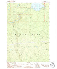
Timothy Lake, Oregon, USGS topographic map dated 1985.
Includes geographic coordinates (latitude and longitude). This topographic map is suitable for hiking, camping, and exploring, or framing it as a wall map.
Printed on-demand using high resolution imagery, on heavy weight and acid free paper, or alternatively on a variety of synthetic materials.
Topos available on paper, Waterproof, Poly, or Tyvek. Usually shipping rolled, unless combined with other folded maps in one order.
- Product Number: USGS-5422310
- Free digital map download (high-resolution, GeoPDF): Timothy Lake, Oregon (file size: 11 MB)
- Map Size: please refer to the dimensions of the GeoPDF map above
- Weight (paper map): ca. 55 grams
- Map Type: POD USGS Topographic Map
- Map Series: HTMC
- Map Verison: Historical
- Cell ID: 45165
- Scan ID: 281836
- Imprint Year: 1985
- Woodland Tint: Yes
- Aerial Photo Year: 1981
- Edit Year: 1985
- Field Check Year: 1983
- Datum: NAD27
- Map Projection: Lambert Conformal Conic
- Provisional map: Yes
- Map published by United States Geological Survey
- Map Language: English
- Scanner Resolution: 600 dpi
- Map Cell Name: Timothy Lake
- Grid size: 7.5 X 7.5 Minute
- Date on map: 1985
- Map Scale: 1:24000
- Geographical region: Oregon, United States
Neighboring Maps:
All neighboring USGS topo maps are available for sale online at a variety of scales.
Spatial coverage:
Topo map Timothy Lake, Oregon, covers the geographical area associated the following places:
- Oak Fork Boat Launch - Cove Recreation Site - Gone Creek Recreation Site - Rock Butte - Buck Creek Quarry - Peavine Mountain - Hood View Recreation Site - Stone Creek - Summit Lake Recreation Site - Timothy Lake Dam - Skyline Alternate Trail - Pine Point Recreation Site - Buck Creek - Dry Creek Spring - Summit Lake - Alligator Quarry - Pine Point Boat Launch - Dinger Creek - Snive Creek - Warm Springs Meadow Trail - Peavine Spring - Gemini Quarries - Rock Spring - Summit Lake Trail - Oak Fork Recreation Site - Fire Spring - Timothy Lake - Rimtie Quarry - Buck Lake - Gone Creek Boat Launch - Aquarius Spring - Anvil Creek - Timothy Meadows (historical) - Sheep Spring - Hoodview Campground Boat Launch - Chief Creek - Stone Creek Gravel Pit - Rock Springs Trail
- Map Area ID: AREA45.12545-121.875-121.75
- Northwest corner Lat/Long code: USGSNW45.125-121.875
- Northeast corner Lat/Long code: USGSNE45.125-121.75
- Southwest corner Lat/Long code: USGSSW45-121.875
- Southeast corner Lat/Long code: USGSSE45-121.75
- Northern map edge Latitude: 45.125
- Southern map edge Latitude: 45
- Western map edge Longitude: -121.875
- Eastern map edge Longitude: -121.75


