
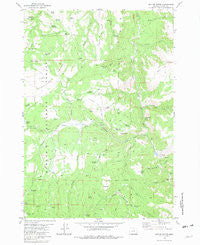
~ Suplee Butte OR topo map, 1:24000 scale, 7.5 X 7.5 Minute, Historical, 1981, updated 1981
Suplee Butte, Oregon, USGS topographic map dated 1981.
Includes geographic coordinates (latitude and longitude). This topographic map is suitable for hiking, camping, and exploring, or framing it as a wall map.
Printed on-demand using high resolution imagery, on heavy weight and acid free paper, or alternatively on a variety of synthetic materials.
Topos available on paper, Waterproof, Poly, or Tyvek. Usually shipping rolled, unless combined with other folded maps in one order.
- Product Number: USGS-5422060
- Free digital map download (high-resolution, GeoPDF): Suplee Butte, Oregon (file size: 11 MB)
- Map Size: please refer to the dimensions of the GeoPDF map above
- Weight (paper map): ca. 55 grams
- Map Type: POD USGS Topographic Map
- Map Series: HTMC
- Map Verison: Historical
- Cell ID: 43893
- Scan ID: 281709
- Imprint Year: 1981
- Woodland Tint: Yes
- Aerial Photo Year: 1974
- Edit Year: 1981
- Field Check Year: 1976
- Datum: NAD27
- Map Projection: Lambert Conformal Conic
- Map published by United States Geological Survey
- Map Language: English
- Scanner Resolution: 600 dpi
- Map Cell Name: Suplee Butte
- Grid size: 7.5 X 7.5 Minute
- Date on map: 1981
- Map Scale: 1:24000
- Geographical region: Oregon, United States
Neighboring Maps:
All neighboring USGS topo maps are available for sale online at a variety of scales.
Spatial coverage:
Topo map Suplee Butte, Oregon, covers the geographical area associated the following places:
- Big Mowich Reservoir - Trail Creek - Cayuse Reservoir - Santa Claus Stream - Negro Cabin - Fort Creek - Fort Reservoir - Wildhorse Reservoir - South Fork Falls - Porcupine Reservoir - Junction Creek - Sedge Two Reservoir - Hobble Spring - Robinson Homestead - Hard Scrabble Reservoir - South Fork Wind Creek - Davis Creek - Cinnabar Flat - Skid Seep - Art Reservoir - Spur Butte - Wildcat Creek - Sedge Reservoir - Blue Spring - Sugarloaf - Hobnail Reservoir - Holding Pasture - Wildhorse Spring - Sugarloaf Mountain - Basin Creek - Porcupine Creek - Little Frazier Creek - Coyote Reservoir - Dual Reservoir - Sunflower Creek - Viewpoint Reservoir - Little Fir Creek - Blue Pot Spring - Santa Claus Spring - Cougar Creek - Bernard Mill - Frazier Recreation Site - Murray Flat - Strip Spring - Willow Spring - Deer Creek - Stump Spring - Davis Creek Reservoir - Buck Spring - Cougar Gulch - Wildcat Spring - Elk Reservoir - Wildhorse Falls Reservoir - Magic Lantern Creek - Suplee Butte - Delore Place - Greenwater Reservoir - Frazier Creek - Ellingson Mill - Little Baldy
- Map Area ID: AREA44.2544.125-119.625-119.5
- Northwest corner Lat/Long code: USGSNW44.25-119.625
- Northeast corner Lat/Long code: USGSNE44.25-119.5
- Southwest corner Lat/Long code: USGSSW44.125-119.625
- Southeast corner Lat/Long code: USGSSE44.125-119.5
- Northern map edge Latitude: 44.25
- Southern map edge Latitude: 44.125
- Western map edge Longitude: -119.625
- Eastern map edge Longitude: -119.5


