
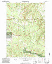
~ Sullivan Gulch OR topo map, 1:24000 scale, 7.5 X 7.5 Minute, Historical, 1995, updated 1998
Sullivan Gulch, Oregon, USGS topographic map dated 1995.
Includes geographic coordinates (latitude and longitude). This topographic map is suitable for hiking, camping, and exploring, or framing it as a wall map.
Printed on-demand using high resolution imagery, on heavy weight and acid free paper, or alternatively on a variety of synthetic materials.
Topos available on paper, Waterproof, Poly, or Tyvek. Usually shipping rolled, unless combined with other folded maps in one order.
- Product Number: USGS-5422008
- Free digital map download (high-resolution, GeoPDF): Sullivan Gulch, Oregon (file size: 16 MB)
- Map Size: please refer to the dimensions of the GeoPDF map above
- Weight (paper map): ca. 55 grams
- Map Type: POD USGS Topographic Map
- Map Series: HTMC
- Map Verison: Historical
- Cell ID: 43677
- Scan ID: 281683
- Imprint Year: 1998
- Woodland Tint: Yes
- Aerial Photo Year: 1994
- Field Check Year: 1995
- Datum: NAD27
- Map Projection: Lambert Conformal Conic
- Map published by United States Geological Survey
- Map published by United States Forest Service
- Map Language: English
- Scanner Resolution: 600 dpi
- Map Cell Name: Sullivan Gulch
- Grid size: 7.5 X 7.5 Minute
- Date on map: 1995
- Map Scale: 1:24000
- Geographical region: Oregon, United States
Neighboring Maps:
All neighboring USGS topo maps are available for sale online at a variety of scales.
Spatial coverage:
Topo map Sullivan Gulch, Oregon, covers the geographical area associated the following places:
- Blarney Spring - Starkey Experimental Forest Headquarters - Little Bear Creek - Four Corners Recreation Site - Umapine Creek - Research Corrals - Tamarack Spring - Lower Bluff Springs - Flat Rock Spring - Half Moon Spring - Frog Heaven Recreation Site - Kaenta Spring - Squaw Creek - Camas Creek Corral - Campbell Spring - Sardine Spring - Camas Spring - Mud Spring - Mud Spring - Red Fir Spring - Doherty Spring - Frog Heaven Meadow - Upper Bluff Spring - Starkey Experimental Forest - A P Spring - Perrin Spring - Tin Troughs Spring - Mud Hole Spring - Bear Spring - Sullivan Spring - Only Entry Point
- Map Area ID: AREA45.2545.125-118.625-118.5
- Northwest corner Lat/Long code: USGSNW45.25-118.625
- Northeast corner Lat/Long code: USGSNE45.25-118.5
- Southwest corner Lat/Long code: USGSSW45.125-118.625
- Southeast corner Lat/Long code: USGSSE45.125-118.5
- Northern map edge Latitude: 45.25
- Southern map edge Latitude: 45.125
- Western map edge Longitude: -118.625
- Eastern map edge Longitude: -118.5


