
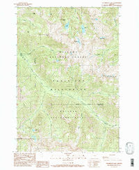
~ Steamboat Lake OR topo map, 1:24000 scale, 7.5 X 7.5 Minute, Historical, 1990, updated 1990
Steamboat Lake, Oregon, USGS topographic map dated 1990.
Includes geographic coordinates (latitude and longitude). This topographic map is suitable for hiking, camping, and exploring, or framing it as a wall map.
Printed on-demand using high resolution imagery, on heavy weight and acid free paper, or alternatively on a variety of synthetic materials.
Topos available on paper, Waterproof, Poly, or Tyvek. Usually shipping rolled, unless combined with other folded maps in one order.
- Product Number: USGS-5421908
- Free digital map download (high-resolution, GeoPDF): Steamboat Lake, Oregon (file size: 18 MB)
- Map Size: please refer to the dimensions of the GeoPDF map above
- Weight (paper map): ca. 55 grams
- Map Type: POD USGS Topographic Map
- Map Series: HTMC
- Map Verison: Historical
- Cell ID: 43021
- Scan ID: 281633
- Imprint Year: 1990
- Woodland Tint: Yes
- Aerial Photo Year: 1981
- Edit Year: 1990
- Field Check Year: 1987
- Datum: NAD27
- Map Projection: Lambert Conformal Conic
- Provisional map: Yes
- Map published by United States Geological Survey
- Map Language: English
- Scanner Resolution: 600 dpi
- Map Cell Name: Steamboat Lake
- Grid size: 7.5 X 7.5 Minute
- Date on map: 1990
- Map Scale: 1:24000
- Geographical region: Oregon, United States
Neighboring Maps:
All neighboring USGS topo maps are available for sale online at a variety of scales.
Spatial coverage:
Topo map Steamboat Lake, Oregon, covers the geographical area associated the following places:
- China Cap Ridge - Hazel Lake - Sturgill Peak - Swamp Lake - Cheval Lake - Elkhorn Peak - Trail Creek - Catched Two Lake - Tombstone Lake - Minam Peak - Glacier Mountain - Diamond Lake - Katy Mountain - Lowry Gulch - Long Lake - Elkhorn Creek - Hazel Mountain - Eagle Cap Wilderness - Steamboat Lake - Wild Sheep Creek - Sky Lake - Elk Creek - Granite Gulch - East Fork Elk Creek - Last Chance Creek - Copper Creek Trail
- Map Area ID: AREA45.2545.125-117.5-117.375
- Northwest corner Lat/Long code: USGSNW45.25-117.5
- Northeast corner Lat/Long code: USGSNE45.25-117.375
- Southwest corner Lat/Long code: USGSSW45.125-117.5
- Southeast corner Lat/Long code: USGSSE45.125-117.375
- Northern map edge Latitude: 45.25
- Southern map edge Latitude: 45.125
- Western map edge Longitude: -117.5
- Eastern map edge Longitude: -117.375


