
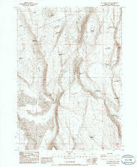
~ St Patrick Mtn OR topo map, 1:24000 scale, 7.5 X 7.5 Minute, Historical, 1986, updated 1986
St Patrick Mtn , Oregon, USGS topographic map dated 1986.
Includes geographic coordinates (latitude and longitude). This topographic map is suitable for hiking, camping, and exploring, or framing it as a wall map.
Printed on-demand using high resolution imagery, on heavy weight and acid free paper, or alternatively on a variety of synthetic materials.
Topos available on paper, Waterproof, Poly, or Tyvek. Usually shipping rolled, unless combined with other folded maps in one order.
- Product Number: USGS-5421866
- Free digital map download (high-resolution, GeoPDF): St Patrick Mtn , Oregon (file size: 13 MB)
- Map Size: please refer to the dimensions of the GeoPDF map above
- Weight (paper map): ca. 55 grams
- Map Type: POD USGS Topographic Map
- Map Series: HTMC
- Map Verison: Historical
- Cell ID: 39367
- Scan ID: 281611
- Imprint Year: 1986
- Aerial Photo Year: 1980
- Edit Year: 1986
- Field Check Year: 1981
- Datum: NAD27
- Map Projection: Lambert Conformal Conic
- Map published by United States Geological Survey
- Map Language: English
- Scanner Resolution: 600 dpi
- Map Cell Name: Saint Patrick Mountain
- Grid size: 7.5 X 7.5 Minute
- Date on map: 1986
- Map Scale: 1:24000
- Geographical region: Oregon, United States
Neighboring Maps:
All neighboring USGS topo maps are available for sale online at a variety of scales.
Spatial coverage:
Topo map St Patrick Mtn , Oregon, covers the geographical area associated the following places:
- Saint Patrick Mountain - State Game Reservoir Number 7 - Dead Reservoir - County Waterhole Number 7 - County Waterhole Number 11 - County Waterhole Number 4 - County Waterhole Number 2 - Rocky Butte - Lower Juniper Waterhole - Emery Well - Spur Rowel Lake - Coyote Bedground Reservoir - Dog Lake Waterhole - Bunker Hill - Coffee Lake - Sand Canyon - Settlement Waterhole - Saint Patrick Mountain Reservoir Number Two - Saint Patrick Reservoir - Black Points - Rocky Waterhole - County Waterhole Number 9 - Coffeepot Basin - Juniper Canyon - Sioux Reservoir - Saint Patrick Lake - Section Line Waterhole - State Game Reservoir Number 6
- Map Area ID: AREA43.12543-120.625-120.5
- Northwest corner Lat/Long code: USGSNW43.125-120.625
- Northeast corner Lat/Long code: USGSNE43.125-120.5
- Southwest corner Lat/Long code: USGSSW43-120.625
- Southeast corner Lat/Long code: USGSSE43-120.5
- Northern map edge Latitude: 43.125
- Southern map edge Latitude: 43
- Western map edge Longitude: -120.625
- Eastern map edge Longitude: -120.5


