
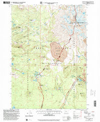
~ South Sister OR topo map, 1:24000 scale, 7.5 X 7.5 Minute, Historical, 1997, updated 2001
South Sister, Oregon, USGS topographic map dated 1997.
Includes geographic coordinates (latitude and longitude). This topographic map is suitable for hiking, camping, and exploring, or framing it as a wall map.
Printed on-demand using high resolution imagery, on heavy weight and acid free paper, or alternatively on a variety of synthetic materials.
Topos available on paper, Waterproof, Poly, or Tyvek. Usually shipping rolled, unless combined with other folded maps in one order.
- Product Number: USGS-5421796
- Free digital map download (high-resolution, GeoPDF): South Sister, Oregon (file size: 14 MB)
- Map Size: please refer to the dimensions of the GeoPDF map above
- Weight (paper map): ca. 55 grams
- Map Type: POD USGS Topographic Map
- Map Series: HTMC
- Map Verison: Historical
- Cell ID: 42296
- Scan ID: 281574
- Imprint Year: 2001
- Woodland Tint: Yes
- Aerial Photo Year: 1995
- Datum: NAD27
- Map Projection: Lambert Conformal Conic
- Map published by United States Geological Survey
- Map published by United States Forest Service
- Map Language: English
- Scanner Resolution: 600 dpi
- Map Cell Name: South Sister
- Grid size: 7.5 X 7.5 Minute
- Date on map: 1997
- Map Scale: 1:24000
- Geographical region: Oregon, United States
Neighboring Maps:
All neighboring USGS topo maps are available for sale online at a variety of scales.
Spatial coverage:
Topo map South Sister, Oregon, covers the geographical area associated the following places:
- Eugene Glacier - Frazier Upland - Reese Lake - James Creek - James Creek Shelter - Lancelot Lake - Camelot Lake - Devils Lake Recreation Site - Hodge Crest - Junco Lake - Hell Creek - Cole Chuck Meadow - Top Lake - Lewis Glacier - Horse Lake - Wickiup Plain Trail - Rock Mesa - Wickiup Plain - Red Hill - Talapus Butte - Mirror Lake Trail - Devils Hill - Indian Holes - Tyee Creek - Moraine Lake Trail - Denude Lake - Indian Hole Falls - Satan Creek - Koosah Mountain - Kokostick Butte - The Wife - Satan Creek Forest Camp - Devils Lake - Carver Lake - Sphinx Butte - Clark Glacier - Lost Creek Glacier - Honey Lake - Teardrop Pool - Mesa Springs - Dew Lake - Prouty Glacier - Devils Garden Forest Camp (historical) - Katsuk Butte - South Sister - Blacktail Spring - Kaleetan Butte - The House Rock - Le Conte Crater - Moraine Lake - Separation Creek Meadow - Bounty Lake - Skinner Glacier - Sisters Mirror Lake - Hinton Creek - Three Sisters - Burnt Top
- Map Area ID: AREA44.12544-121.875-121.75
- Northwest corner Lat/Long code: USGSNW44.125-121.875
- Northeast corner Lat/Long code: USGSNE44.125-121.75
- Southwest corner Lat/Long code: USGSSW44-121.875
- Southeast corner Lat/Long code: USGSSE44-121.75
- Northern map edge Latitude: 44.125
- Southern map edge Latitude: 44
- Western map edge Longitude: -121.875
- Eastern map edge Longitude: -121.75


