
~ Skeleton Mtn OR topo map, 1:24000 scale, 7.5 X 7.5 Minute, Historical, 1983, updated 1983
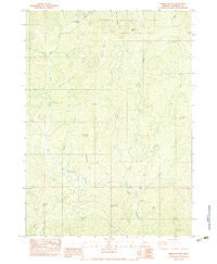
Skeleton Mtn, Oregon, USGS topographic map dated 1983.
Includes geographic coordinates (latitude and longitude). This topographic map is suitable for hiking, camping, and exploring, or framing it as a wall map.
Printed on-demand using high resolution imagery, on heavy weight and acid free paper, or alternatively on a variety of synthetic materials.
Topos available on paper, Waterproof, Poly, or Tyvek. Usually shipping rolled, unless combined with other folded maps in one order.
- Product Number: USGS-5421730
- Free digital map download (high-resolution, GeoPDF): Skeleton Mtn, Oregon (file size: 13 MB)
- Map Size: please refer to the dimensions of the GeoPDF map above
- Weight (paper map): ca. 55 grams
- Map Type: POD USGS Topographic Map
- Map Series: HTMC
- Map Verison: Historical
- Cell ID: 41577
- Scan ID: 281541
- Imprint Year: 1983
- Woodland Tint: Yes
- Aerial Photo Year: 1976
- Edit Year: 1983
- Field Check Year: 1978
- Datum: NAD27
- Map Projection: Lambert Conformal Conic
- Provisional map: Yes
- Map published by United States Geological Survey
- Map Language: English
- Scanner Resolution: 600 dpi
- Map Cell Name: Skeleton Mountain
- Grid size: 7.5 X 7.5 Minute
- Date on map: 1983
- Map Scale: 1:24000
- Geographical region: Oregon, United States
Neighboring Maps:
All neighboring USGS topo maps are available for sale online at a variety of scales.
Spatial coverage:
Topo map Skeleton Mtn, Oregon, covers the geographical area associated the following places:
- Slick Rock Creek - Salt Creek Recreation Site (historical) - Panther Peak - White Rock Mountain - Steinmetz Creek - Goolaway Gap - Cold Creek - Horse Mountain - Peavine Ridge - Little Battle Mountain - Right Fork Salt Creek - Angel Camp - Bear Wallow - Sam Creek - Elderberry Flat Recreation Site - Skeleton Mountain - Lick Creek - Rock Creek - Elderberry Flat - Spignet Butte - Salt Creek - Elderberry Creek - Salt Creek Guard Station - Sand Creek - Sand Bar Gulch - Fry Peak - Battle Mountain - Willow Flat - Salt Spring - Swamp Creek - Ash Flat - Cedar Creek
- Map Area ID: AREA42.7542.625-123.125-123
- Northwest corner Lat/Long code: USGSNW42.75-123.125
- Northeast corner Lat/Long code: USGSNE42.75-123
- Southwest corner Lat/Long code: USGSSW42.625-123.125
- Southeast corner Lat/Long code: USGSSE42.625-123
- Northern map edge Latitude: 42.75
- Southern map edge Latitude: 42.625
- Western map edge Longitude: -123.125
- Eastern map edge Longitude: -123


