
~ Sexton Mtn OR topo map, 1:24000 scale, 7.5 X 7.5 Minute, Historical, 1986, updated 1986
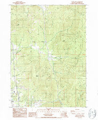
Sexton Mtn, Oregon, USGS topographic map dated 1986.
Includes geographic coordinates (latitude and longitude). This topographic map is suitable for hiking, camping, and exploring, or framing it as a wall map.
Printed on-demand using high resolution imagery, on heavy weight and acid free paper, or alternatively on a variety of synthetic materials.
Topos available on paper, Waterproof, Poly, or Tyvek. Usually shipping rolled, unless combined with other folded maps in one order.
- Product Number: USGS-5421544
- Free digital map download (high-resolution, GeoPDF): Sexton Mtn, Oregon (file size: 15 MB)
- Map Size: please refer to the dimensions of the GeoPDF map above
- Weight (paper map): ca. 55 grams
- Map Type: POD USGS Topographic Map
- Map Series: HTMC
- Map Verison: Historical
- Cell ID: 40694
- Scan ID: 281448
- Imprint Year: 1986
- Woodland Tint: Yes
- Aerial Photo Year: 1982
- Edit Year: 1986
- Field Check Year: 1984
- Datum: NAD27
- Map Projection: Lambert Conformal Conic
- Provisional map: Yes
- Map published by United States Geological Survey
- Map Language: English
- Scanner Resolution: 600 dpi
- Map Cell Name: Sexton Mountain
- Grid size: 7.5 X 7.5 Minute
- Date on map: 1986
- Map Scale: 1:24000
- Geographical region: Oregon, United States
Neighboring Maps:
All neighboring USGS topo maps are available for sale online at a variety of scales.
Spatial coverage:
Topo map Sexton Mtn, Oregon, covers the geographical area associated the following places:
- Fleming Middle School - Forest Queen - Morris Creek - Winona Post Office (historical) - Manzanita Safety Rest Area - Fall Creek - Lucky Queen Post Office (historical) - Manzanita Elementary School - Corn Creek - Burgess Gulch - Hammersley Post Office (historical) - Horse Creek - King Gulch - Sexton Mountain - Water Branch - Red Mountain - Dunlap Creek - Fleming Middle School Sewage Treatment Plant - Breakdown Creek - Orofino Mine - Lucky Queen Mine - Jack Creek - Rural / Metro Fire Department Station 2 - Walker Mountain - Kettering (historical) - Baby Mine - Grants Pass Division - Cove Creek - Orofino Gulch - Winona (historical) - Gopher Mine - Lucky Queen - North Valley High School - Daisy Mine - Cherry Creek - Roberts Mountain - Twelve O'Clock Mine - Mountain Post Office (historical) - Corliss Creek - Oak Mine - Hammersly Mine - Shorthorn Gulch
- Map Area ID: AREA42.62542.5-123.375-123.25
- Northwest corner Lat/Long code: USGSNW42.625-123.375
- Northeast corner Lat/Long code: USGSNE42.625-123.25
- Southwest corner Lat/Long code: USGSSW42.5-123.375
- Southeast corner Lat/Long code: USGSSE42.5-123.25
- Northern map edge Latitude: 42.625
- Southern map edge Latitude: 42.5
- Western map edge Longitude: -123.375
- Eastern map edge Longitude: -123.25


