
~ Sardine Butte OR topo map, 1:24000 scale, 7.5 X 7.5 Minute, Historical, 1986, updated 1986
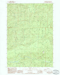
Sardine Butte, Oregon, USGS topographic map dated 1986.
Includes geographic coordinates (latitude and longitude). This topographic map is suitable for hiking, camping, and exploring, or framing it as a wall map.
Printed on-demand using high resolution imagery, on heavy weight and acid free paper, or alternatively on a variety of synthetic materials.
Topos available on paper, Waterproof, Poly, or Tyvek. Usually shipping rolled, unless combined with other folded maps in one order.
- Product Number: USGS-5421444
- Free digital map download (high-resolution, GeoPDF): Sardine Butte, Oregon (file size: 14 MB)
- Map Size: please refer to the dimensions of the GeoPDF map above
- Weight (paper map): ca. 55 grams
- Map Type: POD USGS Topographic Map
- Map Series: HTMC
- Map Verison: Historical
- Cell ID: 39970
- Scan ID: 281399
- Imprint Year: 1986
- Woodland Tint: Yes
- Aerial Photo Year: 1982
- Edit Year: 1986
- Field Check Year: 1983
- Datum: NAD27
- Map Projection: Lambert Conformal Conic
- Provisional map: Yes
- Map published by United States Geological Survey
- Map Language: English
- Scanner Resolution: 600 dpi
- Map Cell Name: Sardine Butte
- Grid size: 7.5 X 7.5 Minute
- Date on map: 1986
- Map Scale: 1:24000
- Geographical region: Oregon, United States
Neighboring Maps:
All neighboring USGS topo maps are available for sale online at a variety of scales.
Spatial coverage:
Topo map Sardine Butte, Oregon, covers the geographical area associated the following places:
- Ingram Butte - Major Creek - Steer Creek - Whiterock Creek - Mill Creek - Christy Flats - Coffee Creek - Nehi Creek - Roosevelt Creek - Kiahanie Recreation Site - Cedar Creek - Sidewalk Creek - Shale Creek - Maple Creek - Grassy Creek - Lefty Creek - Evergreen Creek - Plateau Creek - Parallel Creek - Major Prairie - Sardine Butte - Salt Springs - Sardine Creek - Buzzard Creek - Parker Creek - Battle Peak - Lowell Creek - Camp 5 - Devils Canyon - Mossy Creek - Platt Creek - Buffalo Rock - Silver Creek
- Map Area ID: AREA4443.875-122.375-122.25
- Northwest corner Lat/Long code: USGSNW44-122.375
- Northeast corner Lat/Long code: USGSNE44-122.25
- Southwest corner Lat/Long code: USGSSW43.875-122.375
- Southeast corner Lat/Long code: USGSSE43.875-122.25
- Northern map edge Latitude: 44
- Southern map edge Latitude: 43.875
- Western map edge Longitude: -122.375
- Eastern map edge Longitude: -122.25


