
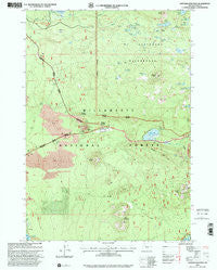
~ Santiam Junction OR topo map, 1:24000 scale, 7.5 X 7.5 Minute, Historical, 1997, updated 2001
Santiam Junction, Oregon, USGS topographic map dated 1997.
Includes geographic coordinates (latitude and longitude). This topographic map is suitable for hiking, camping, and exploring, or framing it as a wall map.
Printed on-demand using high resolution imagery, on heavy weight and acid free paper, or alternatively on a variety of synthetic materials.
Topos available on paper, Waterproof, Poly, or Tyvek. Usually shipping rolled, unless combined with other folded maps in one order.
- Product Number: USGS-5421442
- Free digital map download (high-resolution, GeoPDF): Santiam Junction, Oregon (file size: 14 MB)
- Map Size: please refer to the dimensions of the GeoPDF map above
- Weight (paper map): ca. 55 grams
- Map Type: POD USGS Topographic Map
- Map Series: HTMC
- Map Verison: Historical
- Cell ID: 71519
- Scan ID: 281398
- Imprint Year: 2001
- Woodland Tint: Yes
- Aerial Photo Year: 1995
- Datum: NAD27
- Map Projection: Lambert Conformal Conic
- Map published by United States Geological Survey
- Map published by United States Forest Service
- Map Language: English
- Scanner Resolution: 600 dpi
- Map Cell Name: Santiam Junction
- Grid size: 7.5 X 7.5 Minute
- Date on map: 1997
- Map Scale: 1:24000
- Geographical region: Oregon, United States
Neighboring Maps:
All neighboring USGS topo maps are available for sale online at a variety of scales.
Spatial coverage:
Topo map Santiam Junction, Oregon, covers the geographical area associated the following places:
- Big Lake West Recreation Site - Duffy Lake - Cincha Lake - Maxwell Butte - Swede Creek - Duffy Butte - Lost Lake Creek - Toms Lake - Santiam Junction - Hoodoo Butte - Potato Hill - Lower Berley Lake - Latigo Lake - Train Lake - Lost Lake Campground (historical) - Maxwell Lake - Maxwell Trail - Little Nash Crater - Sand Mountain - Lost Lake - Upper Berley Lake - South Dixie Lake - Santiam Junction State Airport - North Dixie Lake - Little Cincha Lake - Toni Lake - Hoodoo Creek - Big Spring - Ralphs Lake - Alforja Lake - Twin Lakes - Lava Trail - Nash Crater - Hogg Rock - Duffy Lake Trail - Little Duffy Lake - Santiam Lake - Duffy Prairie - Craig Lake - Big Meadows Horse Camp - Great Spring - Lost Lake Campground Unimproved Boat Launch
- Map Area ID: AREA44.544.375-122-121.875
- Northwest corner Lat/Long code: USGSNW44.5-122
- Northeast corner Lat/Long code: USGSNE44.5-121.875
- Southwest corner Lat/Long code: USGSSW44.375-122
- Southeast corner Lat/Long code: USGSSE44.375-121.875
- Northern map edge Latitude: 44.5
- Southern map edge Latitude: 44.375
- Western map edge Longitude: -122
- Eastern map edge Longitude: -121.875


