
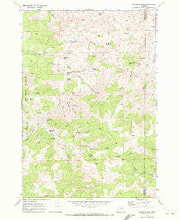
~ Sandrock Mtn OR topo map, 1:24000 scale, 7.5 X 7.5 Minute, Historical, 1968, updated 1972
Sandrock Mtn, Oregon, USGS topographic map dated 1968.
Includes geographic coordinates (latitude and longitude). This topographic map is suitable for hiking, camping, and exploring, or framing it as a wall map.
Printed on-demand using high resolution imagery, on heavy weight and acid free paper, or alternatively on a variety of synthetic materials.
Topos available on paper, Waterproof, Poly, or Tyvek. Usually shipping rolled, unless combined with other folded maps in one order.
- Product Number: USGS-5421422
- Free digital map download (high-resolution, GeoPDF): Sandrock Mtn, Oregon (file size: 13 MB)
- Map Size: please refer to the dimensions of the GeoPDF map above
- Weight (paper map): ca. 55 grams
- Map Type: POD USGS Topographic Map
- Map Series: HTMC
- Map Verison: Historical
- Cell ID: 39819
- Scan ID: 281387
- Imprint Year: 1972
- Woodland Tint: Yes
- Aerial Photo Year: 1967
- Field Check Year: 1968
- Datum: NAD27
- Map Projection: Polyconic
- Map published by United States Geological Survey
- Map Language: English
- Scanner Resolution: 600 dpi
- Map Cell Name: Sandrock Mountain
- Grid size: 7.5 X 7.5 Minute
- Date on map: 1968
- Map Scale: 1:24000
- Geographical region: Oregon, United States
Neighboring Maps:
All neighboring USGS topo maps are available for sale online at a variety of scales.
Spatial coverage:
Topo map Sandrock Mtn, Oregon, covers the geographical area associated the following places:
- Studhorse Canyon - Horse Heaven Mountain - Quail Gulch - Root Gulch - Sheep Rock - Long Hollow - Grade (historical) - Ryestack Gulch - Hole in Wall Rock - Grade Post Office (historical) - Black Rock - Balanced Rocks - Hells Half Acre - Sandrock Mountain - Red Gap - Pine Spring - Blind Gulch - Tompkins Pass - Horse Creek - White Rock Spring - Pine Creek - Upper Cherry Creek Ranch - White Rock Gulch - Broken Shovel Spring - Pine Spring Hollow - Cherry Spring - Log House Spring - Wyman Creek - Kaser Ranch - Sandrock Gulch - Indian Rocks - Cherry Creek Dam - Oler Spring - Sandrock Springs - Little Sandrock Gulch - Kinney Canyon - Dry Creek - Sheep Hollow - Buck Gulch
- Map Area ID: AREA44.7544.625-120.5-120.375
- Northwest corner Lat/Long code: USGSNW44.75-120.5
- Northeast corner Lat/Long code: USGSNE44.75-120.375
- Southwest corner Lat/Long code: USGSSW44.625-120.5
- Southeast corner Lat/Long code: USGSSE44.625-120.375
- Northern map edge Latitude: 44.75
- Southern map edge Latitude: 44.625
- Western map edge Longitude: -120.5
- Eastern map edge Longitude: -120.375


