
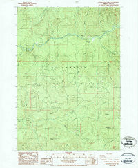
~ Saddleblanket Mountain OR topo map, 1:24000 scale, 7.5 X 7.5 Minute, Historical, 1986, updated 1986
Saddleblanket Mountain, Oregon, USGS topographic map dated 1986.
Includes geographic coordinates (latitude and longitude). This topographic map is suitable for hiking, camping, and exploring, or framing it as a wall map.
Printed on-demand using high resolution imagery, on heavy weight and acid free paper, or alternatively on a variety of synthetic materials.
Topos available on paper, Waterproof, Poly, or Tyvek. Usually shipping rolled, unless combined with other folded maps in one order.
- Product Number: USGS-5421352
- Free digital map download (high-resolution, GeoPDF): Saddleblanket Mountain, Oregon (file size: 15 MB)
- Map Size: please refer to the dimensions of the GeoPDF map above
- Weight (paper map): ca. 55 grams
- Map Type: POD USGS Topographic Map
- Map Series: HTMC
- Map Verison: Historical
- Cell ID: 39153
- Scan ID: 281350
- Imprint Year: 1986
- Woodland Tint: Yes
- Aerial Photo Year: 1982
- Edit Year: 1986
- Field Check Year: 1983
- Datum: NAD27
- Map Projection: Lambert Conformal Conic
- Provisional map: Yes
- Map published by United States Geological Survey
- Map Language: English
- Scanner Resolution: 600 dpi
- Map Cell Name: Saddleblanket Mountain
- Grid size: 7.5 X 7.5 Minute
- Date on map: 1986
- Map Scale: 1:24000
- Geographical region: Oregon, United States
Neighboring Maps:
All neighboring USGS topo maps are available for sale online at a variety of scales.
Spatial coverage:
Topo map Saddleblanket Mountain, Oregon, covers the geographical area associated the following places:
- Saddleblanket Mountain - Chichester Falls - Puma Creek - Clark Butte - Big Pool Recreation Site - Minnehaha Creek - Puma Creek Recreation Site - Fall Creek Guard Station - Little Blanket Shelter - Clark Creek Group Camp - Bedrock Recreation Site - Johnny Creek Nature Trail - Portland Creek - Jones Creek - Blanket Creek - Fall Creek National Recreation Trail - Johnny Creek Recreation Site - South Fork Winberry Creek - Broken Bowl Recreation Site - Clark Creek - Indian Creek - Dolly Varden Recreation Site - Fall Creek Work Center - Boundary Creek - Winberry Mountain - Timber Creek - Rubble Creek - Bedrock Creek - Station Butte - Winberry Recreation Site - Andy Creek - Slick Creek - Timber Butte - Traverse Creek - North Fork Winberry Creek - Brush Creek
- Map Area ID: AREA4443.875-122.625-122.5
- Northwest corner Lat/Long code: USGSNW44-122.625
- Northeast corner Lat/Long code: USGSNE44-122.5
- Southwest corner Lat/Long code: USGSSW43.875-122.625
- Southeast corner Lat/Long code: USGSSE43.875-122.5
- Northern map edge Latitude: 44
- Southern map edge Latitude: 43.875
- Western map edge Longitude: -122.625
- Eastern map edge Longitude: -122.5


