
~ Rustler Peak OR topo map, 1:24000 scale, 7.5 X 7.5 Minute, Historical, 1997, updated 2000
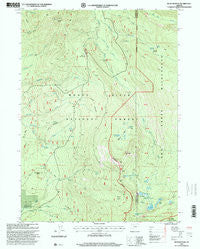
Rustler Peak, Oregon, USGS topographic map dated 1997.
Includes geographic coordinates (latitude and longitude). This topographic map is suitable for hiking, camping, and exploring, or framing it as a wall map.
Printed on-demand using high resolution imagery, on heavy weight and acid free paper, or alternatively on a variety of synthetic materials.
Topos available on paper, Waterproof, Poly, or Tyvek. Usually shipping rolled, unless combined with other folded maps in one order.
- Product Number: USGS-5421342
- Free digital map download (high-resolution, GeoPDF): Rustler Peak, Oregon (file size: 12 MB)
- Map Size: please refer to the dimensions of the GeoPDF map above
- Weight (paper map): ca. 55 grams
- Map Type: POD USGS Topographic Map
- Map Series: HTMC
- Map Verison: Historical
- Cell ID: 39027
- Scan ID: 281344
- Imprint Year: 2000
- Woodland Tint: Yes
- Aerial Photo Year: 1994
- Edit Year: 1997
- Survey Year: 1981
- Datum: NAD27
- Map Projection: Lambert Conformal Conic
- Map published by United States Geological Survey
- Map published by United States Forest Service
- Map Language: English
- Scanner Resolution: 600 dpi
- Map Cell Name: Rustler Peak
- Grid size: 7.5 X 7.5 Minute
- Date on map: 1997
- Map Scale: 1:24000
- Geographical region: Oregon, United States
Neighboring Maps:
All neighboring USGS topo maps are available for sale online at a variety of scales.
Spatial coverage:
Topo map Rustler Peak, Oregon, covers the geographical area associated the following places:
- Goss Trail - Saddle Campground (historical) - Pioneer Post Office (historical) - Wickiup Forest Camp (historical) - Cat Hill - Wickiup Shelter - Misfit Creek - Blue Rock - Wickiup Spring - Rustler Peak - Buck Basin Fork - Beal Lake - Christis Spring - Grassy Pond - Stanley Meadows - Meadow Lake Camp - Gypsy Fork - Wickiup Creek - Mud Lake - Sheep Camp - South Blue Lake Group - Onion Spring - Parker Creek - Carey Lake - Misfit Spring - Blue Lake - Cat Hill Way - Horseshoe Lake - Sheep Camp Glades - Wickiup Meadow - McKee Lake - Meadow Lake - Beaver Fork - Carney Lake Camp (historical) - North Blue Lake Group - Parker Meadows Recreation Site - Blue Canyon Trail - Dole Spring - Round Lake - Gypsy Spring - Pear Lake - Parker Meadows - Snowshoe Butte - Little Butte Creek - Rogue Head Camp - North Fork Fourbit Creek - Blue Canyon Lake - Pear Lake Camp - Salt Fork Fourbit Creek - South Fork Trail - Upper South Fork Campground (historical) - Blue Lake Camp - Snowshoe Forest Camp (historical) - Smith Rock - McKee Basin - South Fork Fourbit Creek - Little Billie Creek - Lily Pond - Buck Basin
- Map Area ID: AREA42.62542.5-122.375-122.25
- Northwest corner Lat/Long code: USGSNW42.625-122.375
- Northeast corner Lat/Long code: USGSNE42.625-122.25
- Southwest corner Lat/Long code: USGSSW42.5-122.375
- Southeast corner Lat/Long code: USGSSE42.5-122.25
- Northern map edge Latitude: 42.625
- Southern map edge Latitude: 42.5
- Western map edge Longitude: -122.375
- Eastern map edge Longitude: -122.25


