
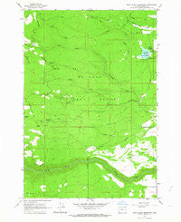
~ Rock Creek Reservoir OR topo map, 1:24000 scale, 7.5 X 7.5 Minute, Historical, 1962, updated 1964
Rock Creek Reservoir, Oregon, USGS topographic map dated 1962.
Includes geographic coordinates (latitude and longitude). This topographic map is suitable for hiking, camping, and exploring, or framing it as a wall map.
Printed on-demand using high resolution imagery, on heavy weight and acid free paper, or alternatively on a variety of synthetic materials.
Topos available on paper, Waterproof, Poly, or Tyvek. Usually shipping rolled, unless combined with other folded maps in one order.
- Product Number: USGS-5421248
- Free digital map download (high-resolution, GeoPDF): Rock Creek Reservoir, Oregon (file size: 10 MB)
- Map Size: please refer to the dimensions of the GeoPDF map above
- Weight (paper map): ca. 55 grams
- Map Type: POD USGS Topographic Map
- Map Series: HTMC
- Map Verison: Historical
- Cell ID: 38226
- Scan ID: 281295
- Imprint Year: 1964
- Woodland Tint: Yes
- Aerial Photo Year: 1957
- Field Check Year: 1962
- Datum: NAD27
- Map Projection: Polyconic
- Map published by United States Geological Survey
- Map Language: English
- Scanner Resolution: 600 dpi
- Map Cell Name: Rock Creek Reservoir
- Grid size: 7.5 X 7.5 Minute
- Date on map: 1962
- Map Scale: 1:24000
- Geographical region: Oregon, United States
Neighboring Maps:
All neighboring USGS topo maps are available for sale online at a variety of scales.
Spatial coverage:
Topo map Rock Creek Reservoir, Oregon, covers the geographical area associated the following places:
- Rock Creek Reservoir Work Center - North Fork Hazel Hollow - Pine Hollow Volunteer Fire Department Station 2 - Bus Point - Immigrant Spring - Washburn Spring - Camp Cody - North Fork Gate Creek - Smarts Reservoir - Lost Boulder Ditch - Rock Creek Dam - Rock Creek Reservoir - Souva Creek - South Fork Gate Creek - Miller Reservoir - Rock Creek Reservoir Campground - Rock Creek Campground Boat Ramp - Lower White River Wilderness - Clear Point - Rock Creek Guard Station - Wamic Elementary School (historical) - Pup Creek - Wildcat Creek - North Fork Rock Creek
- Map Area ID: AREA45.2545.125-121.5-121.375
- Northwest corner Lat/Long code: USGSNW45.25-121.5
- Northeast corner Lat/Long code: USGSNE45.25-121.375
- Southwest corner Lat/Long code: USGSSW45.125-121.5
- Southeast corner Lat/Long code: USGSSE45.125-121.375
- Northern map edge Latitude: 45.25
- Southern map edge Latitude: 45.125
- Western map edge Longitude: -121.5
- Eastern map edge Longitude: -121.375


