
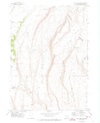
~ Rock Camp Draw OR topo map, 1:24000 scale, 7.5 X 7.5 Minute, Historical, 1971, updated 1974
Rock Camp Draw, Oregon, USGS topographic map dated 1971.
Includes geographic coordinates (latitude and longitude). This topographic map is suitable for hiking, camping, and exploring, or framing it as a wall map.
Printed on-demand using high resolution imagery, on heavy weight and acid free paper, or alternatively on a variety of synthetic materials.
Topos available on paper, Waterproof, Poly, or Tyvek. Usually shipping rolled, unless combined with other folded maps in one order.
- Product Number: USGS-5421244
- Free digital map download (high-resolution, GeoPDF): Rock Camp Draw, Oregon (file size: 9 MB)
- Map Size: please refer to the dimensions of the GeoPDF map above
- Weight (paper map): ca. 55 grams
- Map Type: POD USGS Topographic Map
- Map Series: HTMC
- Map Verison: Historical
- Cell ID: 38209
- Scan ID: 281293
- Imprint Year: 1974
- Woodland Tint: Yes
- Aerial Photo Year: 1969
- Field Check Year: 1971
- Datum: NAD27
- Map Projection: Lambert Conformal Conic
- Map published by United States Geological Survey
- Map Language: English
- Scanner Resolution: 600 dpi
- Map Cell Name: Rock Camp Draw
- Grid size: 7.5 X 7.5 Minute
- Date on map: 1971
- Map Scale: 1:24000
- Geographical region: Oregon, United States
Neighboring Maps:
All neighboring USGS topo maps are available for sale online at a variety of scales.
Spatial coverage:
Topo map Rock Camp Draw, Oregon, covers the geographical area associated the following places:
- Anderson Cabin - Mule Spring Reservoir - Lake Bed Waterhole - North Desert Waterhole Number Nineteen - Rock Camp Lake - North Desert Waterhole Number Thirty-Two - Little Draw - Little Ridge Lake - Hole Waterhole - Juniper Ridge - Drum Reservoir - Mulehole Waterhole - Speck Waterhole - Mule Tit - Mule Waterhole - Juniper Canyon - Dooley Bedground Reservoir - Con Drum Reservoir - Flyspeck Waterhole - Open Draw - Brushy Valley - Hemmy Cabin - Monahan Lake - Mule Springs Valley - Old Jims Lake - Bed Rock Waterhole - Mule Spring - Con Reservoir - Rock Camp Draw - Aspen Reservoir
- Map Area ID: AREA4342.875-119.625-119.5
- Northwest corner Lat/Long code: USGSNW43-119.625
- Northeast corner Lat/Long code: USGSNE43-119.5
- Southwest corner Lat/Long code: USGSSW42.875-119.625
- Southeast corner Lat/Long code: USGSSE42.875-119.5
- Northern map edge Latitude: 43
- Southern map edge Latitude: 42.875
- Western map edge Longitude: -119.625
- Eastern map edge Longitude: -119.5


