
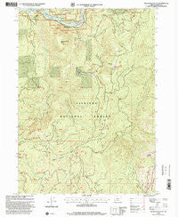
~ Quosatana Butte OR topo map, 1:24000 scale, 7.5 X 7.5 Minute, Historical, 1998, updated 2001
Quosatana Butte, Oregon, USGS topographic map dated 1998.
Includes geographic coordinates (latitude and longitude). This topographic map is suitable for hiking, camping, and exploring, or framing it as a wall map.
Printed on-demand using high resolution imagery, on heavy weight and acid free paper, or alternatively on a variety of synthetic materials.
Topos available on paper, Waterproof, Poly, or Tyvek. Usually shipping rolled, unless combined with other folded maps in one order.
- Product Number: USGS-5421068
- Free digital map download (high-resolution, GeoPDF): Quosatana Butte, Oregon (file size: 17 MB)
- Map Size: please refer to the dimensions of the GeoPDF map above
- Weight (paper map): ca. 55 grams
- Map Type: POD USGS Topographic Map
- Map Series: HTMC
- Map Verison: Historical
- Cell ID: 36848
- Scan ID: 281204
- Imprint Year: 2001
- Woodland Tint: Yes
- Aerial Photo Year: 1994
- Edit Year: 1998
- Survey Year: 1984
- Datum: NAD27
- Map Projection: Lambert Conformal Conic
- Map published by United States Geological Survey
- Map published by United States Forest Service
- Map Language: English
- Scanner Resolution: 600 dpi
- Map Cell Name: Quosatana Butte
- Grid size: 7.5 X 7.5 Minute
- Date on map: 1998
- Map Scale: 1:24000
- Geographical region: Oregon, United States
Neighboring Maps:
All neighboring USGS topo maps are available for sale online at a variety of scales.
Spatial coverage:
Topo map Quosatana Butte, Oregon, covers the geographical area associated the following places:
- Quosatana Butte - Wildhorse Recreation Site - Curry County - Saddle Mountain - Skookumhouse Butte - Quosatana Campground Boat Ramp - South Fork Lawson Creek - Wildhorse Lookout - Rogue National Wild and Scenic River - Quosatana Creek Riffle - Quosatana Creek - Fry Landing - Coal Riffle - Bradford Creek - Lowery Riffle - Little Silver Creek - Sugarloaf Mountain - Skookumhouse Canyon - Fritsche Cabin - Big Fish Riffle - Bowman Ranch - Bacon Flat Riffle - Hayes Eddy - Wilson Cabin - Elko Camp Recreation Site - Quosation Post Office (historical) - Bill Moore Creek - Quosatana Recreation Site - Wildhorse Prairie
- Map Area ID: AREA42.542.375-124.25-124.125
- Northwest corner Lat/Long code: USGSNW42.5-124.25
- Northeast corner Lat/Long code: USGSNE42.5-124.125
- Southwest corner Lat/Long code: USGSSW42.375-124.25
- Southeast corner Lat/Long code: USGSSE42.375-124.125
- Northern map edge Latitude: 42.5
- Southern map edge Latitude: 42.375
- Western map edge Longitude: -124.25
- Eastern map edge Longitude: -124.125


