
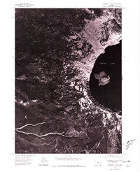
~ Prospect 1 NW OR topo map, 1:24000 scale, 7.5 X 7.5 Minute, Historical, 1975, updated 1980
Prospect 1 NW, Oregon, USGS topographic map dated 1975.
Includes geographic coordinates (latitude and longitude). This topographic map is suitable for hiking, camping, and exploring, or framing it as a wall map.
Printed on-demand using high resolution imagery, on heavy weight and acid free paper, or alternatively on a variety of synthetic materials.
Topos available on paper, Waterproof, Poly, or Tyvek. Usually shipping rolled, unless combined with other folded maps in one order.
- Product Number: USGS-5421020
- Free digital map download (high-resolution, GeoPDF): Prospect 1 NW, Oregon (file size: 18 MB)
- Map Size: please refer to the dimensions of the GeoPDF map above
- Weight (paper map): ca. 55 grams
- Map Type: POD USGS Topographic Map
- Map Series: HTMC
- Map Verison: Historical
- Cell ID: 10607
- Scan ID: 281179
- Imprint Year: 1980
- Aerial Photo Year: 1975
- Datum: NAD27
- Map Projection: Lambert Conformal Conic
- Orthophoto: Quad
- Map published by United States Geological Survey
- Map Language: English
- Scanner Resolution: 600 dpi
- Map Cell Name: Crater Lake West
- Grid size: 7.5 X 7.5 Minute
- Date on map: 1975
- Map Scale: 1:24000
- Geographical region: Oregon, United States
Neighboring Maps:
All neighboring USGS topo maps are available for sale online at a variety of scales.
Spatial coverage:
Topo map Prospect 1 NW, Oregon, covers the geographical area associated the following places:
- Skell Channel - Discovery Point - Red Cone Spring - Castle Crest - Whitehorse Creek - Elephants Back - Rim Village - Bybee Meadow Trail - Lightening Spring Trail - Fumarole Bay - Devils Backbone - Lightning Spring - Llaos Hallway - Williams Crater - Crater Lake Lodge - Crater Lake National Park - Whitehorse Bluff - Crater Lake National Park Headquarters - Hillman Peak - Summit Cascade Divide - Llao Rock - Wizard Island - Trapper Creek - Munson Point - Victor Rock - South Fork Copeland Creek - Middle Fork Copeland Creek - Governors Bay - Dutton Creek - Sinnott Memorial - Cascade Divide Trail - Witches Cauldron - Eagle Cove - Munson Springs - Munson Ridge - The Watchman - Rim Village Picnic Area - Whitehorse Pond - Red Cone - Crater Lake National Park Fire Department - Llao Bay - Crater Lake Post Office - Dutton Creek Trail - Rim of the Crater - Merriam Point - National Park Service Crater Lake National Park Ranger Station - Castle Creek Trail
- Map Area ID: AREA4342.875-122.25-122.125
- Northwest corner Lat/Long code: USGSNW43-122.25
- Northeast corner Lat/Long code: USGSNE43-122.125
- Southwest corner Lat/Long code: USGSSW42.875-122.25
- Southeast corner Lat/Long code: USGSSE42.875-122.125
- Northern map edge Latitude: 43
- Southern map edge Latitude: 42.875
- Western map edge Longitude: -122.25
- Eastern map edge Longitude: -122.125


