
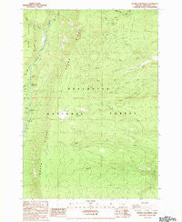
~ Prairie Farm Spring OR topo map, 1:24000 scale, 7.5 X 7.5 Minute, Historical, 1988, updated 1988
Prairie Farm Spring, Oregon, USGS topographic map dated 1988.
Includes geographic coordinates (latitude and longitude). This topographic map is suitable for hiking, camping, and exploring, or framing it as a wall map.
Printed on-demand using high resolution imagery, on heavy weight and acid free paper, or alternatively on a variety of synthetic materials.
Topos available on paper, Waterproof, Poly, or Tyvek. Usually shipping rolled, unless combined with other folded maps in one order.
- Product Number: USGS-5420994
- Free digital map download (high-resolution, GeoPDF): Prairie Farm Spring, Oregon (file size: 16 MB)
- Map Size: please refer to the dimensions of the GeoPDF map above
- Weight (paper map): ca. 55 grams
- Map Type: POD USGS Topographic Map
- Map Series: HTMC
- Map Verison: Historical
- Cell ID: 36318
- Scan ID: 281166
- Imprint Year: 1988
- Woodland Tint: Yes
- Aerial Photo Year: 1984
- Edit Year: 1988
- Field Check Year: 1985
- Datum: NAD27
- Map Projection: Lambert Conformal Conic
- Provisional map: Yes
- Map published by United States Geological Survey
- Map Language: English
- Scanner Resolution: 600 dpi
- Map Cell Name: Prairie Farm Spring
- Grid size: 7.5 X 7.5 Minute
- Date on map: 1988
- Map Scale: 1:24000
- Geographical region: Oregon, United States
Neighboring Maps:
All neighboring USGS topo maps are available for sale online at a variety of scales.
Spatial coverage:
Topo map Prairie Farm Spring, Oregon, covers the geographical area associated the following places:
- Candle Creek - Jefferson Creek - North Fork Street Creek - South Fork Bean Creek - Candle Creek Recreation Site - Bridge 99 - Six Creek Spring - Sheep Creek - Reservation Trail - Mariel Creek - Alder Spring - Lower Bridge Recreation Site - Green Ridge Lookout Tower - Pioneer Ford Recreation Site - Middle Fork Street Creek - Sugar Pine Camp - North Fork Spring Creek - Walker Creek - Prairie Farm Spring - North Fork Bean Creek - Alder Spring Creek - Meadow Creek - South Fork Street Creek - South Fork Spring Creek - Prairie Farm Guard Station (historical) - Grandview Division - Abbot Creek - Green Ridge
- Map Area ID: AREA44.62544.5-121.625-121.5
- Northwest corner Lat/Long code: USGSNW44.625-121.625
- Northeast corner Lat/Long code: USGSNE44.625-121.5
- Southwest corner Lat/Long code: USGSSW44.5-121.625
- Southeast corner Lat/Long code: USGSSE44.5-121.5
- Northern map edge Latitude: 44.625
- Southern map edge Latitude: 44.5
- Western map edge Longitude: -121.625
- Eastern map edge Longitude: -121.5


