
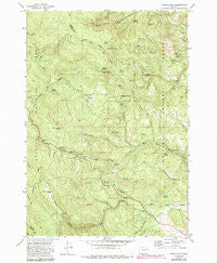
~ Pogue Point OR topo map, 1:24000 scale, 7.5 X 7.5 Minute, Historical, 1972, updated 1985
Pogue Point, Oregon, USGS topographic map dated 1972.
Includes geographic coordinates (latitude and longitude). This topographic map is suitable for hiking, camping, and exploring, or framing it as a wall map.
Printed on-demand using high resolution imagery, on heavy weight and acid free paper, or alternatively on a variety of synthetic materials.
Topos available on paper, Waterproof, Poly, or Tyvek. Usually shipping rolled, unless combined with other folded maps in one order.
- Product Number: USGS-5420894
- Free digital map download (high-resolution, GeoPDF): Pogue Point, Oregon (file size: 17 MB)
- Map Size: please refer to the dimensions of the GeoPDF map above
- Weight (paper map): ca. 55 grams
- Map Type: POD USGS Topographic Map
- Map Series: HTMC
- Map Verison: Historical
- Cell ID: 35755
- Scan ID: 281113
- Imprint Year: 1985
- Woodland Tint: Yes
- Photo Revision Year: 1984
- Aerial Photo Year: 1981
- Edit Year: 1984
- Field Check Year: 1972
- Datum: NAD27
- Map Projection: Lambert Conformal Conic
- Map published by United States Geological Survey
- Map Language: English
- Scanner Resolution: 600 dpi
- Map Cell Name: Pogue Point
- Grid size: 7.5 X 7.5 Minute
- Date on map: 1972
- Map Scale: 1:24000
- Geographical region: Oregon, United States
Neighboring Maps:
All neighboring USGS topo maps are available for sale online at a variety of scales.
Spatial coverage:
Topo map Pogue Point, Oregon, covers the geographical area associated the following places:
- Yellow Pine Recreation Site - Fourth Creek - Mosquito Spring - Oregon Recreation Site - Road Creek - Cold Spring - Skunk Cabbage Spring - Smith Spring - Low Pass Spring - Road Creek Spring - Morg Spring - North Sister Creek - Sheep Spring - Munn Dam - Wallow Spring - Lyman Meadow - Pogue Point - Middle Sister Creek - Sherman Creek - Crusher Spring - Busby Spring - Summit Spring - South Sister Creek - Joe Spring - Elliot Spring - Dead End Spring - Wiggler Spring - Wetmore Recreation Site - Summit Meadow - Rock Pond - North Fork Summit Creek - Horse Spring - Roys Spring - Blue Mountain Summit - Lee Spring - Fourth Creek Camp - Rock Spring - Dons Spring - Lew Spring - Pogue Spring - Starveout Spring - Lyman Meadow Spring - Thompson Spring - Munn Reservoir - Webb Gulch - Little Spring - Petticoat Creek - Elk Spring
- Map Area ID: AREA44.62544.5-118.375-118.25
- Northwest corner Lat/Long code: USGSNW44.625-118.375
- Northeast corner Lat/Long code: USGSNE44.625-118.25
- Southwest corner Lat/Long code: USGSSW44.5-118.375
- Southeast corner Lat/Long code: USGSSE44.5-118.25
- Northern map edge Latitude: 44.625
- Southern map edge Latitude: 44.5
- Western map edge Longitude: -118.375
- Eastern map edge Longitude: -118.25


