
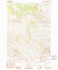
~ Picture Gorge West OR topo map, 1:24000 scale, 7.5 X 7.5 Minute, Historical, 1990, updated 1990
Picture Gorge West, Oregon, USGS topographic map dated 1990.
Includes geographic coordinates (latitude and longitude). This topographic map is suitable for hiking, camping, and exploring, or framing it as a wall map.
Printed on-demand using high resolution imagery, on heavy weight and acid free paper, or alternatively on a variety of synthetic materials.
Topos available on paper, Waterproof, Poly, or Tyvek. Usually shipping rolled, unless combined with other folded maps in one order.
- Product Number: USGS-5420844
- Free digital map download (high-resolution, GeoPDF): Picture Gorge West, Oregon (file size: 14 MB)
- Map Size: please refer to the dimensions of the GeoPDF map above
- Weight (paper map): ca. 55 grams
- Map Type: POD USGS Topographic Map
- Map Series: HTMC
- Map Verison: Historical
- Cell ID: 35044
- Scan ID: 281087
- Imprint Year: 1990
- Woodland Tint: Yes
- Aerial Photo Year: 1984
- Edit Year: 1990
- Field Check Year: 1986
- Datum: NAD27
- Map Projection: Lambert Conformal Conic
- Provisional map: Yes
- Map published by United States Geological Survey
- Map Language: English
- Scanner Resolution: 600 dpi
- Map Cell Name: Picture Gorge West
- Grid size: 7.5 X 7.5 Minute
- Date on map: 1990
- Map Scale: 1:24000
- Geographical region: Oregon, United States
Neighboring Maps:
All neighboring USGS topo maps are available for sale online at a variety of scales.
Spatial coverage:
Topo map Picture Gorge West, Oregon, covers the geographical area associated the following places:
- Mule Gulch - Goose Rock - Waterspout Gulch - John Day Fossil Beds National Monument - Dick Creek - John Day Fossil Beds National Monument Cant Ranch Museum - Rock Creek - Deer Gulch - Buckhorn Creek - Old Johnson Cabin - Hog Ridge - Old Armunger Cabin - Humphrey Ranch - Johnny Kirk Spring - National Park Service John Day Fossil Beds National Monument Ranger Station - Johnny Creek - Goose Creek - Picture Gorge - Butler Basin - Birch Creek - Old Buckhorn Ranch - Juniper Gulch - Goose Rock Bridge - Frank Creek - Artman Basin - Indian Creek - Deep Creek - Lone Pine Trail - Jerrys Draw - Tri-Creek Ranch - Sheep Rock - Thomas Condon Paleontology Center - Jerrys Ridge - Little Rattlesnake Creek - Cal Smith Spring - Mountain Creek
- Map Area ID: AREA44.62544.5-119.75-119.625
- Northwest corner Lat/Long code: USGSNW44.625-119.75
- Northeast corner Lat/Long code: USGSNE44.625-119.625
- Southwest corner Lat/Long code: USGSSW44.5-119.75
- Southeast corner Lat/Long code: USGSSE44.5-119.625
- Northern map edge Latitude: 44.625
- Southern map edge Latitude: 44.5
- Western map edge Longitude: -119.75
- Eastern map edge Longitude: -119.625


