
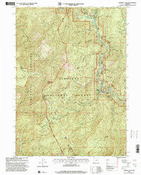
~ Pearsoll Peak OR topo map, 1:24000 scale, 7.5 X 7.5 Minute, Historical, 1998, updated 2001
Pearsoll Peak, Oregon, USGS topographic map dated 1998.
Includes geographic coordinates (latitude and longitude). This topographic map is suitable for hiking, camping, and exploring, or framing it as a wall map.
Printed on-demand using high resolution imagery, on heavy weight and acid free paper, or alternatively on a variety of synthetic materials.
Topos available on paper, Waterproof, Poly, or Tyvek. Usually shipping rolled, unless combined with other folded maps in one order.
- Product Number: USGS-5420792
- Free digital map download (high-resolution, GeoPDF): Pearsoll Peak, Oregon (file size: 19 MB)
- Map Size: please refer to the dimensions of the GeoPDF map above
- Weight (paper map): ca. 55 grams
- Map Type: POD USGS Topographic Map
- Map Series: HTMC
- Map Verison: Historical
- Cell ID: 34555
- Scan ID: 281059
- Imprint Year: 2001
- Woodland Tint: Yes
- Aerial Photo Year: 1994
- Edit Year: 1998
- Survey Year: 1982
- Datum: NAD27
- Map Projection: Lambert Conformal Conic
- Map published by United States Geological Survey
- Map published by United States Forest Service
- Map Language: English
- Scanner Resolution: 600 dpi
- Map Cell Name: Pearsoll Peak
- Grid size: 7.5 X 7.5 Minute
- Date on map: 1998
- Map Scale: 1:24000
- Geographical region: Oregon, United States
Neighboring Maps:
All neighboring USGS topo maps are available for sale online at a variety of scales.
Spatial coverage:
Topo map Pearsoll Peak, Oregon, covers the geographical area associated the following places:
- Castle Rock - Robertson Mine - Eagle Mountain - Knapke Gulch - Nome Creek - McGuire Gulch - Hall Cabin - Store Gulch Recreation Site - Uncle Sam Mine - Eagles Nest Mine - Bowser Mine - Telephone Creek - McCaleb Ranch - Eagle Gap - Deep Gorge Mine - Horse Flat - Gold Basin Butte - Little Siberia Mine - Rancherie Creek - Fall Creek - Pearsoll Creek - Bills Gulch - Granite Spring - Golden Eagle Mine (historical) - Miami Bar Boat Launch - Peck Mine - Miami Bar - Lightning Creek - School Flat - Labrador Creek - Oak Flat Creek - Babyfoot Creek - Baker Creek - Albright Mine (historical) - Chrome King Mine - Store Gulch Guard Station - Oak Flat - Dailey Creek - O'Conner Creek - Five Finger Gulch - Crater Creek - Chetco Pass Creek - Sourdough Flat - Eureka Mine - Pearsoll Mine - Chetco Pass - Twin Cedars Creek - Nome Peak - Pearsoll Peak - Myrtle Creek - Mill Creek - Cox Mine (historical) - Slide Creek - Miller Creek - Hustis Mine (historical) - Golden Dreams Mine (historical) - Fall Creek Copper Mine - Salmon Creek - Store Gulch - Marsh Creek - West Fork Rancherie Creek
- Map Area ID: AREA42.37542.25-123.875-123.75
- Northwest corner Lat/Long code: USGSNW42.375-123.875
- Northeast corner Lat/Long code: USGSNE42.375-123.75
- Southwest corner Lat/Long code: USGSSW42.25-123.875
- Southeast corner Lat/Long code: USGSSE42.25-123.75
- Northern map edge Latitude: 42.375
- Southern map edge Latitude: 42.25
- Western map edge Longitude: -123.875
- Eastern map edge Longitude: -123.75


