
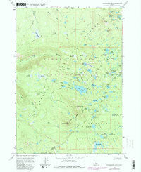
~ Packsaddle Mtn OR topo map, 1:24000 scale, 7.5 X 7.5 Minute, Historical, 1963, updated 1981
Packsaddle Mtn, Oregon, USGS topographic map dated 1963.
Includes geographic coordinates (latitude and longitude). This topographic map is suitable for hiking, camping, and exploring, or framing it as a wall map.
Printed on-demand using high resolution imagery, on heavy weight and acid free paper, or alternatively on a variety of synthetic materials.
Topos available on paper, Waterproof, Poly, or Tyvek. Usually shipping rolled, unless combined with other folded maps in one order.
- Product Number: USGS-5420728
- Free digital map download (high-resolution, GeoPDF): Packsaddle Mtn, Oregon (file size: 13 MB)
- Map Size: please refer to the dimensions of the GeoPDF map above
- Weight (paper map): ca. 55 grams
- Map Type: POD USGS Topographic Map
- Map Series: HTMC
- Map Verison: Historical
- Cell ID: 33851
- Scan ID: 281025
- Imprint Year: 1981
- Woodland Tint: Yes
- Photo Revision Year: 1981
- Aerial Photo Year: 1979
- Edit Year: 1981
- Field Check Year: 1963
- Datum: NAD27
- Map Projection: Polyconic
- Map published by United States Geological Survey
- Map Language: English
- Scanner Resolution: 600 dpi
- Map Cell Name: Packsaddle Mountain
- Grid size: 7.5 X 7.5 Minute
- Date on map: 1963
- Map Scale: 1:24000
- Geographical region: Oregon, United States
Neighboring Maps:
All neighboring USGS topo maps are available for sale online at a variety of scales.
Spatial coverage:
Topo map Packsaddle Mtn, Oregon, covers the geographical area associated the following places:
- Top Lake - Vogel Lake - Big Finger Lake - Cliff Lake Shelter - Snowshoe Lake - Beaver Marsh - Mac Lake - Nightshade Lakes - Corral Draw - East Fisher Lake - Wildcat Trail - Reserve Meadow - Mink Lake Loop Trail - Slipper Lake - Platt Lake - Moody Lake - Horse Mountain Trail - Desane Lake - Little Roundtop Mountain - Packsaddle Mountain - Shroy Meadows - Long Lake - Starwano Way - Lindh Lake - Little Finger Lake - Upper Snowshoe Lake - Mud Lake Trail - Mile Lake - Cougar Flat - Mink Lake Shelter - Puppy Lake - S Lake - Rock Lake - Horse Mountain - Ledge Lake - Island Lake - Vera Lake - Petes Lake - Elk Meadows - Cabin Meadows - Porky Lake - McBee Trail - Questionmark Lake - Goose Lake Trail - Krag Lake - Junction Lake - Merrill Lake - Corral Flat - Herb Lake - Goose Lake - Lookout Lake - Plumb Lake - Wildcat Swamp - Park Lake - Copepod Lake - Lake Way - Marten Lake - Dealy Way - Sandy Lake - Dealy Meadows - Brushy Draw Way - Boot Lake - Packsaddle Mountain Trail - Wright Spring - Elk Creek Trail - Gnat Lake - Spy Lake - Park Trail - Mud Lake Cutoff Trail - Horseshoe Lake - Mink Lake Basin - Snowshoe Lake Trail - Winopee Lake - South Fork Way - Cliff Lake - Mud Lake - Lakeside Trail - McBee Lake - Cow Swamp - West Fisher Lake - Dumbbell Lake - Penn Lake - Mink Lake - Martin Way - Bill Gott Spring - Martin Lake - Corner Lake
- Map Area ID: AREA4443.875-122-121.875
- Northwest corner Lat/Long code: USGSNW44-122
- Northeast corner Lat/Long code: USGSNE44-121.875
- Southwest corner Lat/Long code: USGSSW43.875-122
- Southeast corner Lat/Long code: USGSSE43.875-121.875
- Northern map edge Latitude: 44
- Southern map edge Latitude: 43.875
- Western map edge Longitude: -122
- Eastern map edge Longitude: -121.875


