
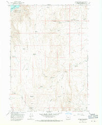
~ Owyhee Ridge OR topo map, 1:24000 scale, 7.5 X 7.5 Minute, Historical, 1967, updated 1971
Owyhee Ridge, Oregon, USGS topographic map dated 1967.
Includes geographic coordinates (latitude and longitude). This topographic map is suitable for hiking, camping, and exploring, or framing it as a wall map.
Printed on-demand using high resolution imagery, on heavy weight and acid free paper, or alternatively on a variety of synthetic materials.
Topos available on paper, Waterproof, Poly, or Tyvek. Usually shipping rolled, unless combined with other folded maps in one order.
- Product Number: USGS-5420708
- Free digital map download (high-resolution, GeoPDF): Owyhee Ridge, Oregon (file size: 10 MB)
- Map Size: please refer to the dimensions of the GeoPDF map above
- Weight (paper map): ca. 55 grams
- Map Type: POD USGS Topographic Map
- Map Series: HTMC
- Map Verison: Historical
- Cell ID: 33757
- Scan ID: 281015
- Imprint Year: 1971
- Aerial Photo Year: 1967
- Field Check Year: 1967
- Datum: NAD27
- Map Projection: Polyconic
- Map published by United States Geological Survey
- Map Language: English
- Scanner Resolution: 600 dpi
- Map Cell Name: Owyhee Ridge
- Grid size: 7.5 X 7.5 Minute
- Date on map: 1967
- Map Scale: 1:24000
- Geographical region: Oregon, United States
Neighboring Maps:
All neighboring USGS topo maps are available for sale online at a variety of scales.
Spatial coverage:
Topo map Owyhee Ridge, Oregon, covers the geographical area associated the following places:
- South Branch Camp Kettle Creek - Stark Reservoir - Bas Reservoir - Gordon Creek - Board Corral Spring - Swigert Cow Camp - Lake Owyhee Gordon Gulch Day Use Boat Ramp - Rock Fence Reservoir - Camp Kettle Reservoir - Gordon Gulch - Board Corral Mountain - Danny Boy Spring - Calhoun Reservoir - North Branch Camp Kettle Creek - Bench Reservoir - Birch Creek Reservoir - The Tongue - Monument Spring - Cabin Springs - Board Corral Reservoir - Devils Gate - North Alkali Spring - Lake Owyhee State Park - Sage Creek - Three Fingers Spring - Alkali Draw Reservoir
- Map Area ID: AREA43.62543.5-117.25-117.125
- Northwest corner Lat/Long code: USGSNW43.625-117.25
- Northeast corner Lat/Long code: USGSNE43.625-117.125
- Southwest corner Lat/Long code: USGSSW43.5-117.25
- Southeast corner Lat/Long code: USGSSE43.5-117.125
- Northern map edge Latitude: 43.625
- Southern map edge Latitude: 43.5
- Western map edge Longitude: -117.25
- Eastern map edge Longitude: -117.125


