
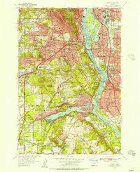
~ Oswego OR topo map, 1:24000 scale, 7.5 X 7.5 Minute, Historical, 1954, updated 1957
Oswego, Oregon, USGS topographic map dated 1954.
Includes geographic coordinates (latitude and longitude). This topographic map is suitable for hiking, camping, and exploring, or framing it as a wall map.
Printed on-demand using high resolution imagery, on heavy weight and acid free paper, or alternatively on a variety of synthetic materials.
Topos available on paper, Waterproof, Poly, or Tyvek. Usually shipping rolled, unless combined with other folded maps in one order.
- Product Number: USGS-5420692
- Free digital map download (high-resolution, GeoPDF): Oswego, Oregon (file size: 20 MB)
- Map Size: please refer to the dimensions of the GeoPDF map above
- Weight (paper map): ca. 55 grams
- Map Type: POD USGS Topographic Map
- Map Series: HTMC
- Map Verison: Historical
- Cell ID: 24600
- Scan ID: 281007
- Imprint Year: 1957
- Woodland Tint: Yes
- Aerial Photo Year: 1952
- Field Check Year: 1954
- Datum: NAD27
- Map Projection: Polyconic
- Map published by United States Geological Survey
- Map Language: English
- Scanner Resolution: 600 dpi
- Map Cell Name: Lake Oswego
- Grid size: 7.5 X 7.5 Minute
- Date on map: 1954
- Map Scale: 1:24000
- Geographical region: Oregon, United States
Neighboring Maps:
All neighboring USGS topo maps are available for sale online at a variety of scales.
Spatial coverage:
Topo map Oswego, Oregon, covers the geographical area associated the following places:
- Robinwood - Shadowood - Burlingame - Lake Oswego - Bertha (historical) - Cook - Marquam Hill - Milwaukie - Milwaukie Heights - Sellwood - Johns Landing - Briarwood - West Portland Park - Oak Grove - West Portland - Lakewood - Bridlemile - Christie (historical) - Jean - Dunthorpe - Bryant - Ardenwald - Kellogg Park - Glencullen - Maplewood - Riverwood - Vermont Hills - Multnomah - Lake Grove (historical) - Carson Heights - Capitol Hill - Villa Ridge - Rivergrove - South Portland (historical) - Concord - Marylhurst - Waverly Heights - Hillsdale - Englewood - Riverdale - Rosewood - Fair Oaks - Fulton (historical) - Brooklyn - Westmoreland - South Lake Oswego
- Map Area ID: AREA45.545.375-122.75-122.625
- Northwest corner Lat/Long code: USGSNW45.5-122.75
- Northeast corner Lat/Long code: USGSNE45.5-122.625
- Southwest corner Lat/Long code: USGSSW45.375-122.75
- Southeast corner Lat/Long code: USGSSE45.375-122.625
- Northern map edge Latitude: 45.5
- Southern map edge Latitude: 45.375
- Western map edge Longitude: -122.75
- Eastern map edge Longitude: -122.625


