
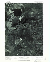
~ Newberry Crater 4 NW OR topo map, 1:24000 scale, 7.5 X 7.5 Minute, Historical, 1974, updated 1978
Newberry Crater 4 NW, Oregon, USGS topographic map dated 1974.
Includes geographic coordinates (latitude and longitude). This topographic map is suitable for hiking, camping, and exploring, or framing it as a wall map.
Printed on-demand using high resolution imagery, on heavy weight and acid free paper, or alternatively on a variety of synthetic materials.
Topos available on paper, Waterproof, Poly, or Tyvek. Usually shipping rolled, unless combined with other folded maps in one order.
- Product Number: USGS-5420526
- Free digital map download (high-resolution, GeoPDF): Newberry Crater 4 NW, Oregon (file size: 20 MB)
- Map Size: please refer to the dimensions of the GeoPDF map above
- Weight (paper map): ca. 55 grams
- Map Type: POD USGS Topographic Map
- Map Series: HTMC
- Map Verison: Historical
- Cell ID: 13386
- Scan ID: 280919
- Imprint Year: 1978
- Datum: NAD27
- Map Projection: Lambert Conformal Conic
- Orthophoto: Quad
- Map published by United States Geological Survey
- Keywords: Nonstandard Press Run
- Map Language: English
- Scanner Resolution: 600 dpi
- Map Cell Name: East Lake
- Grid size: 7.5 X 7.5 Minute
- Date on map: 1974
- Map Scale: 1:24000
- Geographical region: Oregon, United States
Neighboring Maps:
All neighboring USGS topo maps are available for sale online at a variety of scales.
Spatial coverage:
Topo map Newberry Crater 4 NW, Oregon, covers the geographical area associated the following places:
- Big Obsidian Flow Trailhead - Newberry National Volcanic Monument - East Lake Resort Marina - Kweo Butte - Topso Butte - The Dome - East Lake Resort - Sand Butte - Weasel Butte - Newberry Crater - East Lake Campground Boat Ramp - Red Hill - East Lake - Central Pumice Cone - Warm Springs Campground (historical) - East Lake Recreation Site - Cinder Hill Campground Boat Ramp - Little Crater Campground Boat Ramp - Little Crater Recreation Site - Hot Springs Boating Site - North Paulina Peak - Newberry Volcano - Devils Horn - Box Butte - Cinder Hill Recreation Site - Hot Springs Recreation Site
- Map Area ID: AREA43.7543.625-121.25-121.125
- Northwest corner Lat/Long code: USGSNW43.75-121.25
- Northeast corner Lat/Long code: USGSNE43.75-121.125
- Southwest corner Lat/Long code: USGSSW43.625-121.25
- Southeast corner Lat/Long code: USGSSE43.625-121.125
- Northern map edge Latitude: 43.75
- Southern map edge Latitude: 43.625
- Western map edge Longitude: -121.25
- Eastern map edge Longitude: -121.125


