
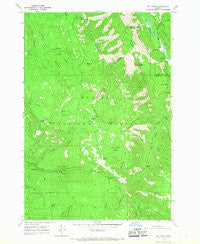
~ Mt Fanny OR topo map, 1:24000 scale, 7.5 X 7.5 Minute, Historical, 1965, updated 1967
Mt Fanny, Oregon, USGS topographic map dated 1965.
Includes geographic coordinates (latitude and longitude). This topographic map is suitable for hiking, camping, and exploring, or framing it as a wall map.
Printed on-demand using high resolution imagery, on heavy weight and acid free paper, or alternatively on a variety of synthetic materials.
Topos available on paper, Waterproof, Poly, or Tyvek. Usually shipping rolled, unless combined with other folded maps in one order.
- Product Number: USGS-5420406
- Free digital map download (high-resolution, GeoPDF): Mt Fanny, Oregon (file size: 13 MB)
- Map Size: please refer to the dimensions of the GeoPDF map above
- Weight (paper map): ca. 55 grams
- Map Type: POD USGS Topographic Map
- Map Series: HTMC
- Map Verison: Historical
- Cell ID: 30585
- Scan ID: 280857
- Imprint Year: 1967
- Woodland Tint: Yes
- Aerial Photo Year: 1963
- Field Check Year: 1965
- Datum: NAD27
- Map Projection: Polyconic
- Map published by United States Geological Survey
- Map Language: English
- Scanner Resolution: 600 dpi
- Map Cell Name: Mount Fanny
- Grid size: 7.5 X 7.5 Minute
- Date on map: 1965
- Map Scale: 1:24000
- Geographical region: Oregon, United States
Neighboring Maps:
All neighboring USGS topo maps are available for sale online at a variety of scales.
Spatial coverage:
Topo map Mt Fanny, Oregon, covers the geographical area associated the following places:
- Lucky Spring - Castle Ridge - Moss Springs Horse Camp - Lower Falls Little Minam River - Huckleberry Trail - Bridge Creek - East Fork Indian Creek - Reds Wallowa Horse Ranch Airport - Boulder Creek - KTVR-TV - Fireline Creek - Reds Horse Ranch - Horseshoe Basin - Huckleberry Creek - Moss Springs Recreation Site - Ben Point - Mount Fanny - Whiskey Flat - Threemile Creek - Moss Spring - Mount Harris Recreation Site - Dobbin Creek - Lodgepole Trail - Lodgepole Spring - Horseshoe Spring - Dunns Bluff - Point Prominence - Mount Fanny Spring - Minam Lodge Airport - Indian Creek Camp - Horseheaven Creek - Big Canyon - Little Minam Meadow - Grizzly Creek - Long Ridge - Backbone Ridge - Yew Spring - Bell Creek - Barrel Spring - Pine Butte - Summit Spring - Horseshoe Creek - Minam Lodge - Fool Hen Spring
- Map Area ID: AREA45.37545.25-117.75-117.625
- Northwest corner Lat/Long code: USGSNW45.375-117.75
- Northeast corner Lat/Long code: USGSNE45.375-117.625
- Southwest corner Lat/Long code: USGSSW45.25-117.75
- Southeast corner Lat/Long code: USGSSE45.25-117.625
- Northern map edge Latitude: 45.375
- Southern map edge Latitude: 45.25
- Western map edge Longitude: -117.75
- Eastern map edge Longitude: -117.625


