
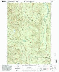
~ Mount Lowe OR topo map, 1:24000 scale, 7.5 X 7.5 Minute, Historical, 1997, updated 1999
Mount Lowe, Oregon, USGS topographic map dated 1997.
Includes geographic coordinates (latitude and longitude). This topographic map is suitable for hiking, camping, and exploring, or framing it as a wall map.
Printed on-demand using high resolution imagery, on heavy weight and acid free paper, or alternatively on a variety of synthetic materials.
Topos available on paper, Waterproof, Poly, or Tyvek. Usually shipping rolled, unless combined with other folded maps in one order.
- Product Number: USGS-5420338
- Free digital map download (high-resolution, GeoPDF): Mount Lowe, Oregon (file size: 15 MB)
- Map Size: please refer to the dimensions of the GeoPDF map above
- Weight (paper map): ca. 55 grams
- Map Type: POD USGS Topographic Map
- Map Series: HTMC
- Map Verison: Historical
- Cell ID: 30699
- Scan ID: 280823
- Imprint Year: 1999
- Woodland Tint: Yes
- Aerial Photo Year: 1995
- Edit Year: 1997
- Survey Year: 1982
- Datum: NAD27
- Map Projection: Lambert Conformal Conic
- Map published by United States Geological Survey
- Map published by United States Forest Service
- Map Language: English
- Scanner Resolution: 600 dpi
- Map Cell Name: Mount Lowe
- Grid size: 7.5 X 7.5 Minute
- Date on map: 1997
- Map Scale: 1:24000
- Geographical region: Oregon, United States
Neighboring Maps:
All neighboring USGS topo maps are available for sale online at a variety of scales.
Spatial coverage:
Topo map Mount Lowe, Oregon, covers the geographical area associated the following places:
- Pinhead Creek - Fadeaway Spring - Rhododendron Creek - Hunter Creek - Ochre Creek - Bonner Creek - Last Creek - Squirrel Quarry - June Creek Pit - Hunter Creek Trail - Mount Lowe - Lacy Pit - Fawn Meadow Pit - Fawn Creek - Bob Meadow - Rho Ridge Shelter - Campbell Creek - Hunter Pit - Cub Creek - Rhododendron Ridge - Wall Creek - Beaver Dam Quarry - Rhododendron Meadow - Cul de sac Quarry - Lowe Creek Trail - Graham Pass - Round Creek - Sisi Creek - Kansas Creek - Lowe Creek Pit - Jim Meadow - Fawn Meadow - Round Lake - Marion Quarry - Hunter Camp Way - Saddle Springs - Tarzan Springs - Round Lake Recreation Site - Wall Quarry - Rhododendron Ridge Shelter - Eds Meadow - Rhododendron Ridge Trail - Lowe Creek - Tumble Creek - Burnt Granite
- Map Area ID: AREA4544.875-122-121.875
- Northwest corner Lat/Long code: USGSNW45-122
- Northeast corner Lat/Long code: USGSNE45-121.875
- Southwest corner Lat/Long code: USGSSW44.875-122
- Southeast corner Lat/Long code: USGSSE44.875-121.875
- Northern map edge Latitude: 45
- Southern map edge Latitude: 44.875
- Western map edge Longitude: -122
- Eastern map edge Longitude: -121.875


