
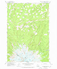
~ Mount Hood North OR topo map, 1:24000 scale, 7.5 X 7.5 Minute, Historical, 1962, updated 1979
Mount Hood North, Oregon, USGS topographic map dated 1962.
Includes geographic coordinates (latitude and longitude). This topographic map is suitable for hiking, camping, and exploring, or framing it as a wall map.
Printed on-demand using high resolution imagery, on heavy weight and acid free paper, or alternatively on a variety of synthetic materials.
Topos available on paper, Waterproof, Poly, or Tyvek. Usually shipping rolled, unless combined with other folded maps in one order.
- Product Number: USGS-5420316
- Free digital map download (high-resolution, GeoPDF): Mount Hood North, Oregon (file size: 13 MB)
- Map Size: please refer to the dimensions of the GeoPDF map above
- Weight (paper map): ca. 55 grams
- Map Type: POD USGS Topographic Map
- Map Series: HTMC
- Map Verison: Historical
- Cell ID: 30637
- Scan ID: 280811
- Imprint Year: 1979
- Woodland Tint: Yes
- Aerial Photo Year: 1956
- Field Check Year: 1962
- Datum: NAD27
- Map Projection: Polyconic
- Map published by United States Geological Survey
- Map Language: English
- Scanner Resolution: 600 dpi
- Map Cell Name: Mount Hood North
- Grid size: 7.5 X 7.5 Minute
- Date on map: 1962
- Map Scale: 1:24000
- Geographical region: Oregon, United States
Neighboring Maps:
All neighboring USGS topo maps are available for sale online at a variety of scales.
Spatial coverage:
Topo map Mount Hood North, Oregon, covers the geographical area associated the following places:
- Kinnikinnick Recreation Site - Coe Branch - Red Hill - Ghost Ridge - Clear Branch Dam - Recession Lakes - Sandy Glacier - Cloud Cap Saddle Recreation Site - Dollar Lake - Eliot Branch - Clear Branch - Elk Grove Trail - Cooper Spur - The Pinnacle - McNeil Point - Pulpit Rock - Reservoir Campground - Perry Lake - Bear Creek - Cathedral Ridge - Langille Glacier - Squeegee Creek - Red Hill Guard Station - Compass Creek - Cloud Cap-Tilly Jane Historic Area - Timberline Trail - Ladd Glacier - Stump Creek Trail - Boomer Creek - Elk Cove - File Butte - Pinnacle Creek - Langille Crags - Cairn Basin - Vista Ridge - Tilly Jane Recreation Site - Dollar Quarry - Coe Glacier - Tilly Jane Guard Station - Wallalute Falls - Stranahan Ridge - Eden Park - Barrett Spur - Cooper Spur Ski Trail - Pinnacle Ridge Trail - Laurance Lake - Wy'east Basin - Eliot Glacier - Laurance Lake Boat Ramp - Sandy Glacier Headwall - Tilly Jane Trail - Yocum Ridge - Vista Ridge Trail - Inspiration Point - Glisan Glacier - Cloud Cap Inn
- Map Area ID: AREA45.545.375-121.75-121.625
- Northwest corner Lat/Long code: USGSNW45.5-121.75
- Northeast corner Lat/Long code: USGSNE45.5-121.625
- Southwest corner Lat/Long code: USGSSW45.375-121.75
- Southeast corner Lat/Long code: USGSSE45.375-121.625
- Northern map edge Latitude: 45.5
- Southern map edge Latitude: 45.375
- Western map edge Longitude: -121.75
- Eastern map edge Longitude: -121.625


