
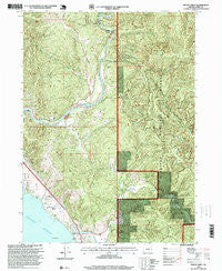
~ Mount Emily OR topo map, 1:24000 scale, 7.5 X 7.5 Minute, Historical, 1996, updated 1999
Mount Emily, Oregon, USGS topographic map dated 1996.
Includes geographic coordinates (latitude and longitude). This topographic map is suitable for hiking, camping, and exploring, or framing it as a wall map.
Printed on-demand using high resolution imagery, on heavy weight and acid free paper, or alternatively on a variety of synthetic materials.
Topos available on paper, Waterproof, Poly, or Tyvek. Usually shipping rolled, unless combined with other folded maps in one order.
- Product Number: USGS-5420310
- Free digital map download (high-resolution, GeoPDF): Mount Emily, Oregon (file size: 19 MB)
- Map Size: please refer to the dimensions of the GeoPDF map above
- Weight (paper map): ca. 55 grams
- Map Type: POD USGS Topographic Map
- Map Series: HTMC
- Map Verison: Historical
- Cell ID: 30574
- Scan ID: 280808
- Imprint Year: 1999
- Woodland Tint: Yes
- Aerial Photo Year: 1994
- Edit Year: 1996
- Survey Year: 1984
- Datum: NAD27
- Map Projection: Lambert Conformal Conic
- Map published by United States Geological Survey
- Map published by United States Forest Service
- Map Language: English
- Scanner Resolution: 600 dpi
- Map Cell Name: Mount Emily
- Grid size: 7.5 X 7.5 Minute
- Date on map: 1996
- Map Scale: 1:24000
- Geographical region: Oregon, United States
Neighboring Maps:
All neighboring USGS topo maps are available for sale online at a variety of scales.
Spatial coverage:
Topo map Mount Emily, Oregon, covers the geographical area associated the following places:
- Jordan Creek - Gardner Ridge - Short Ridge - Wildcat Creek - Elk Creek - Deer Creek - Willow Creek - Alfred A Loeb State Park - Johnson Creek - Winchuck State Park - North Fork Chetco River - Hamilton Creek - McVay Rock State Park - Van Pelt Cemetery - Ram Creek - Crissey Field State Park - Jack Creek - Nell Creek - Moore Creek - Chetco Valley Historical Museum - Dry Creek - Alfred A Loeb State Park Boat Launch - Tide Rock - Emily Creek - Camel Rock - McVay Creek - Peavine Ridge - Chetco Post Office (historical) - McVay Rock - Pioneer Cemetery - Winchuck Rural Fire Protection District - Cooley Creek - Upper Chetco Rural Fire Protection District - Winchuck Post Office (historical) - Mill Creek - Upper Chetco Charter School - Chetco (historical) - Winchuck River - Ostenbery Bar - Mount Emily - Moser Creek - Elk Mountain Trail - Carey Creek - Social Security Bar Boat Launch - Boar Backbone - Little Emily Creek - Tamba Ranch
- Map Area ID: AREA42.12542-124.25-124.125
- Northwest corner Lat/Long code: USGSNW42.125-124.25
- Northeast corner Lat/Long code: USGSNE42.125-124.125
- Southwest corner Lat/Long code: USGSSW42-124.25
- Southeast corner Lat/Long code: USGSSE42-124.125
- Northern map edge Latitude: 42.125
- Southern map edge Latitude: 42
- Western map edge Longitude: -124.25
- Eastern map edge Longitude: -124.125


