
~ Mother Lode Mtn OR topo map, 1:24000 scale, 7.5 X 7.5 Minute, Historical, 1994, updated 1998
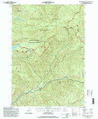
Mother Lode Mtn, Oregon, USGS topographic map dated 1994.
Includes geographic coordinates (latitude and longitude). This topographic map is suitable for hiking, camping, and exploring, or framing it as a wall map.
Printed on-demand using high resolution imagery, on heavy weight and acid free paper, or alternatively on a variety of synthetic materials.
Topos available on paper, Waterproof, Poly, or Tyvek. Usually shipping rolled, unless combined with other folded maps in one order.
- Product Number: USGS-5420292
- Free digital map download (high-resolution, GeoPDF): Mother Lode Mtn, Oregon (file size: 18 MB)
- Map Size: please refer to the dimensions of the GeoPDF map above
- Weight (paper map): ca. 55 grams
- Map Type: POD USGS Topographic Map
- Map Series: HTMC
- Map Verison: Historical
- Cell ID: 30402
- Scan ID: 280799
- Imprint Year: 1998
- Woodland Tint: Yes
- Aerial Photo Year: 1992
- Field Check Year: 1994
- Survey Year: 1981
- Datum: NAD27
- Map Projection: Lambert Conformal Conic
- Map published by United States Geological Survey
- Map published by United States Forest Service
- Map Language: English
- Scanner Resolution: 600 dpi
- Map Cell Name: Mother Lode Mountain
- Grid size: 7.5 X 7.5 Minute
- Date on map: 1994
- Map Scale: 1:24000
- Geographical region: Oregon, United States
Neighboring Maps:
All neighboring USGS topo maps are available for sale online at a variety of scales.
Spatial coverage:
Topo map Mother Lode Mtn, Oregon, covers the geographical area associated the following places:
- Scorpion Mountain Trail - Wind Creek - East Humbug Creek - Deadhorse Creek - Twin Lakes - Twin Lakes Trail - Dunlap Lake - Gold Butte - Elk Lake Trail - Cultus Creek - Fox Creek - Short Mountain - Mother Lode Mountain - East Marion Division - Janus Butte - Slide Creek - Scorpion Creek - Deadhorse Mountain - Dunlap Creek - Byars Creek - Humbug Creek - Eagle Rock - Welcome Lakes Ridge Trail - Leone Creek - Alder Swamp - Battle Creek - Scorpion Ridge Trail - Leone Lake - Cliffs Creek - Mother Lode Trail - Mother Lode Creek - Dunlap Lake Boat Launch - Humbug Ridge Trail - Fox Creek Trail - Humbug Recreation Site - Battle Creek Shelter - Elk Lake
- Map Area ID: AREA44.87544.75-122.125-122
- Northwest corner Lat/Long code: USGSNW44.875-122.125
- Northeast corner Lat/Long code: USGSNE44.875-122
- Southwest corner Lat/Long code: USGSSW44.75-122.125
- Southeast corner Lat/Long code: USGSSE44.75-122
- Northern map edge Latitude: 44.875
- Southern map edge Latitude: 44.75
- Western map edge Longitude: -122.125
- Eastern map edge Longitude: -122


