
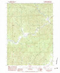
~ Mc Conville Peak OR topo map, 1:24000 scale, 7.5 X 7.5 Minute, Historical, 1983, updated 1983
Mc Conville Peak, Oregon, USGS topographic map dated 1983.
Includes geographic coordinates (latitude and longitude). This topographic map is suitable for hiking, camping, and exploring, or framing it as a wall map.
Printed on-demand using high resolution imagery, on heavy weight and acid free paper, or alternatively on a variety of synthetic materials.
Topos available on paper, Waterproof, Poly, or Tyvek. Usually shipping rolled, unless combined with other folded maps in one order.
- Product Number: USGS-5420056
- Free digital map download (high-resolution, GeoPDF): Mc Conville Peak, Oregon (file size: 16 MB)
- Map Size: please refer to the dimensions of the GeoPDF map above
- Weight (paper map): ca. 55 grams
- Map Type: POD USGS Topographic Map
- Map Series: HTMC
- Map Verison: Historical
- Cell ID: 28283
- Scan ID: 280677
- Imprint Year: 1983
- Woodland Tint: Yes
- Aerial Photo Year: 1976
- Edit Year: 1983
- Field Check Year: 1978
- Datum: NAD27
- Map Projection: Lambert Conformal Conic
- Provisional map: Yes
- Map published by United States Geological Survey
- Map Language: English
- Scanner Resolution: 600 dpi
- Map Cell Name: McConville Peak
- Grid size: 7.5 X 7.5 Minute
- Date on map: 1983
- Map Scale: 1:24000
- Geographical region: Oregon, United States
Neighboring Maps:
All neighboring USGS topo maps are available for sale online at a variety of scales.
Spatial coverage:
Topo map Mc Conville Peak, Oregon, covers the geographical area associated the following places:
- Neathammer Creek - Albright Gulch - Albright Creek - McConville Peak - Gregory Reservoir - Bear Trap Gulch - Oak Gulch - Holcomb Springs - Black Butte - Maple Gulch - May Creek - Blair Reservoir - Stein Gulch - Miller Gulch - Magerly Gulch - Bokel Gulch - False Face Mountain - Hillis Peak - Neathammer Gulch - Wilcox Peak - Elkhorn Butte - Cherry Flat - Devils Garden - Sypher Gulch - Sykes Creek - Bald Mountain - McConville Gulch - Davies Gulch - Fawn Creek - Raspberry Creek - Northwest Jackson Division - Battle Creek - Bybee Springs - Fawn Spring - Lover Gulch - Murphy Gulch - Mineral Creek - Carter Gulch - Braton Hollow - West Fork Evans Creek - Middle Fork Sardine Creek - Big Gulch - Lover Peak - Taylor Gulch - Wells Creek - Ramsey Canyon - Homestead Gulch - Sardine Mountain
- Map Area ID: AREA42.62542.5-123.125-123
- Northwest corner Lat/Long code: USGSNW42.625-123.125
- Northeast corner Lat/Long code: USGSNE42.625-123
- Southwest corner Lat/Long code: USGSSW42.5-123.125
- Southeast corner Lat/Long code: USGSSE42.5-123
- Northern map edge Latitude: 42.625
- Southern map edge Latitude: 42.5
- Western map edge Longitude: -123.125
- Eastern map edge Longitude: -123


