
~ Mc Clellan Mountain OR topo map, 1:24000 scale, 7.5 X 7.5 Minute, Historical, 1998, updated 2000
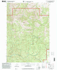
Mc Clellan Mountain, Oregon, USGS topographic map dated 1998.
Includes geographic coordinates (latitude and longitude). This topographic map is suitable for hiking, camping, and exploring, or framing it as a wall map.
Printed on-demand using high resolution imagery, on heavy weight and acid free paper, or alternatively on a variety of synthetic materials.
Topos available on paper, Waterproof, Poly, or Tyvek. Usually shipping rolled, unless combined with other folded maps in one order.
- Product Number: USGS-5420048
- Free digital map download (high-resolution, GeoPDF): Mc Clellan Mountain, Oregon (file size: 17 MB)
- Map Size: please refer to the dimensions of the GeoPDF map above
- Weight (paper map): ca. 55 grams
- Map Type: POD USGS Topographic Map
- Map Series: HTMC
- Map Verison: Historical
- Cell ID: 28252
- Scan ID: 280676
- Imprint Year: 2000
- Woodland Tint: Yes
- Aerial Photo Year: 1994
- Edit Year: 1998
- Survey Year: 1971
- Datum: NAD27
- Map Projection: Lambert Conformal Conic
- Map published by United States Geological Survey
- Map published by United States Forest Service
- Map Language: English
- Scanner Resolution: 600 dpi
- Map Cell Name: McClellan Mountain
- Grid size: 7.5 X 7.5 Minute
- Date on map: 1998
- Map Scale: 1:24000
- Geographical region: Oregon, United States
Neighboring Maps:
All neighboring USGS topo maps are available for sale online at a variety of scales.
Spatial coverage:
Topo map Mc Clellan Mountain, Oregon, covers the geographical area associated the following places:
- The Hole - Cold Spring - Umatilla Creek - Basin Creek - Charlie Mack Creek - Cinnabar Mountain - Third Creek - Cinnabar Mine - Sugar Creek - Alkali Creek - Rail Creek - Riley Creek Meadow - White Creek - Hoppy Spring - Moon Mountain - Dead Horse Mountain - Riley Creek Butte - McClellan Mountain - Packsaddle Gap - Buck Gulch - Grapefruit Creek - Bear Flat - Miner Creek - Spring Gulch - Ingle Mountain - High Trail - Dead Horse Creek - Bear Flat Springs - Ingle Rock - Second Peak - Lime Creek - Packsaddle Canyon - Riley Mountain - First Peak
- Map Area ID: AREA44.37544.25-119.25-119.125
- Northwest corner Lat/Long code: USGSNW44.375-119.25
- Northeast corner Lat/Long code: USGSNE44.375-119.125
- Southwest corner Lat/Long code: USGSSW44.25-119.25
- Southeast corner Lat/Long code: USGSSE44.25-119.125
- Northern map edge Latitude: 44.375
- Southern map edge Latitude: 44.25
- Western map edge Longitude: -119.25
- Eastern map edge Longitude: -119.125


