
~ Logan Valley East OR topo map, 1:24000 scale, 7.5 X 7.5 Minute, Historical, 1988, updated 1988
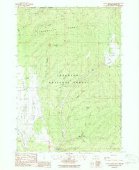
Logan Valley East, Oregon, USGS topographic map dated 1988.
Includes geographic coordinates (latitude and longitude). This topographic map is suitable for hiking, camping, and exploring, or framing it as a wall map.
Printed on-demand using high resolution imagery, on heavy weight and acid free paper, or alternatively on a variety of synthetic materials.
Topos available on paper, Waterproof, Poly, or Tyvek. Usually shipping rolled, unless combined with other folded maps in one order.
- Product Number: USGS-5419836
- Free digital map download (high-resolution, GeoPDF): Logan Valley East, Oregon (file size: 12 MB)
- Map Size: please refer to the dimensions of the GeoPDF map above
- Weight (paper map): ca. 55 grams
- Map Type: POD USGS Topographic Map
- Map Series: HTMC
- Map Verison: Historical
- Cell ID: 26276
- Scan ID: 280565
- Imprint Year: 1988
- Woodland Tint: Yes
- Aerial Photo Year: 1984
- Edit Year: 1988
- Field Check Year: 1986
- Datum: NAD27
- Map Projection: Lambert Conformal Conic
- Provisional map: Yes
- Map published by United States Geological Survey
- Map Language: English
- Scanner Resolution: 600 dpi
- Map Cell Name: Logan Valley East
- Grid size: 7.5 X 7.5 Minute
- Date on map: 1988
- Map Scale: 1:24000
- Geographical region: Oregon, United States
Neighboring Maps:
All neighboring USGS topo maps are available for sale online at a variety of scales.
Spatial coverage:
Topo map Logan Valley East, Oregon, covers the geographical area associated the following places:
- Basket Spring - Meadow Fork Big Creek - French Cabin - Snowshoe Camp - Wickiup Creek - Wickiup Campground (historical) - Larch Creek - Wickiup Spring - Big Creek Recreation Site - Tamarack Creek - Skyline Trailhead - Logan Valley - Corral Basin Creek - Summit Prairie Truck Barns (historical) - Keystone Gulch - Little Logan Creek - Conroy Spring - Snowshoe Trailhead - Engineers Springs (historical) - Joice Spring - Bosonberg Creek - Conroy Creek - Summit Prairie - Snowshoe Creek - Kimberling Cabin (historical) - Corral Basin - Sky Line Camp
- Map Area ID: AREA44.2544.125-118.625-118.5
- Northwest corner Lat/Long code: USGSNW44.25-118.625
- Northeast corner Lat/Long code: USGSNE44.25-118.5
- Southwest corner Lat/Long code: USGSSW44.125-118.625
- Southeast corner Lat/Long code: USGSSE44.125-118.5
- Northern map edge Latitude: 44.25
- Southern map edge Latitude: 44.125
- Western map edge Longitude: -118.625
- Eastern map edge Longitude: -118.5


