
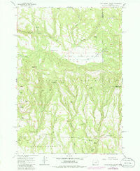
~ Little Summit Prairie OR topo map, 1:24000 scale, 7.5 X 7.5 Minute, Historical, 1966, updated 1985
Little Summit Prairie, Oregon, USGS topographic map dated 1966.
Includes geographic coordinates (latitude and longitude). This topographic map is suitable for hiking, camping, and exploring, or framing it as a wall map.
Printed on-demand using high resolution imagery, on heavy weight and acid free paper, or alternatively on a variety of synthetic materials.
Topos available on paper, Waterproof, Poly, or Tyvek. Usually shipping rolled, unless combined with other folded maps in one order.
- Product Number: USGS-5419812
- Free digital map download (high-resolution, GeoPDF): Little Summit Prairie, Oregon (file size: 13 MB)
- Map Size: please refer to the dimensions of the GeoPDF map above
- Weight (paper map): ca. 55 grams
- Map Type: POD USGS Topographic Map
- Map Series: HTMC
- Map Verison: Historical
- Cell ID: 26056
- Scan ID: 280553
- Imprint Year: 1985
- Woodland Tint: Yes
- Photo Revision Year: 1985
- Aerial Photo Year: 1982
- Edit Year: 1985
- Field Check Year: 1982
- Datum: NAD27
- Map Projection: Polyconic
- Map published by United States Geological Survey
- Map Language: English
- Scanner Resolution: 600 dpi
- Map Cell Name: Little Summit Prairie
- Grid size: 7.5 X 7.5 Minute
- Date on map: 1966
- Map Scale: 1:24000
- Geographical region: Oregon, United States
Neighboring Maps:
All neighboring USGS topo maps are available for sale online at a variety of scales.
Spatial coverage:
Topo map Little Summit Prairie, Oregon, covers the geographical area associated the following places:
- Paulina Butte - Paulina Spring - Hook Reservoir - Ochoco National Forest - Bog Spring - Big Springs Recreation Site - Stump Spring - Post Spring - Bee Reservoir - Dozer Spring - West Thornton Creek - Big Spring - Hewed Log Spring - Higgins Spring - Timothy Meadow - Meadow Reservoir - Quicksand Spring - Little Summit Prairie - Marg Lake - Camp Reservoir - Wilson Spring - Corral Reservoir - Roba Butte - Thornton Creek - Little Summit Campground - Roba Spring - Round Meadow - Morgan Reservoir - Dublin Spring - Ruby Reservoir - Wasp Reservoir
- Map Area ID: AREA44.37544.25-120-119.875
- Northwest corner Lat/Long code: USGSNW44.375-120
- Northeast corner Lat/Long code: USGSNE44.375-119.875
- Southwest corner Lat/Long code: USGSSW44.25-120
- Southeast corner Lat/Long code: USGSSE44.25-119.875
- Northern map edge Latitude: 44.375
- Southern map edge Latitude: 44.25
- Western map edge Longitude: -120
- Eastern map edge Longitude: -119.875


