
~ Little Honey Creek OR topo map, 1:24000 scale, 7.5 X 7.5 Minute, Historical, 2004, updated 2007
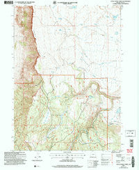
Little Honey Creek, Oregon, USGS topographic map dated 2004.
Includes geographic coordinates (latitude and longitude). This topographic map is suitable for hiking, camping, and exploring, or framing it as a wall map.
Printed on-demand using high resolution imagery, on heavy weight and acid free paper, or alternatively on a variety of synthetic materials.
Topos available on paper, Waterproof, Poly, or Tyvek. Usually shipping rolled, unless combined with other folded maps in one order.
- Product Number: USGS-5419802
- Free digital map download (high-resolution, GeoPDF): Little Honey Creek, Oregon (file size: 13 MB)
- Map Size: please refer to the dimensions of the GeoPDF map above
- Weight (paper map): ca. 55 grams
- Map Type: POD USGS Topographic Map
- Map Series: HTMC
- Map Verison: Historical
- Cell ID: 25977
- Scan ID: 280548
- Imprint Year: 2007
- Woodland Tint: Yes
- Aerial Photo Year: 2001
- Edit Year: 2000
- Datum: NAD83
- Map Projection: Universal Transverse Mercator
- Map published by United States Geological Survey
- Map published by United States Forest Service
- Map Language: English
- Scanner Resolution: 600 dpi
- Map Cell Name: Little Honey Creek
- Grid size: 7.5 X 7.5 Minute
- Date on map: 2004
- Map Scale: 1:24000
- Geographical region: Oregon, United States
Neighboring Maps:
All neighboring USGS topo maps are available for sale online at a variety of scales.
Spatial coverage:
Topo map Little Honey Creek, Oregon, covers the geographical area associated the following places:
- Can Spring - Second Swale Creek - Chandler Cabin - Fitzgerald Dam - First Swale Creek - Vee Lake - Washing Machine Flat - Camp Warner (historical) - Swale Trailhead - Priday Lake - Can Spring Recreation Site - O'Hallihan Spring - Blue Spring - Vee Springs - Fish Creek Waterhole Number Forty-four - Pine Spring - White Pine Marsh - Little Honey Creek - Abert Spring - Vee Lake Trailhead - Fitzgerald Reservoir - Priday Spring - Vee Lake Boat Access - Abert Rim Viewpoint
- Map Area ID: AREA42.542.375-120.25-120.125
- Northwest corner Lat/Long code: USGSNW42.5-120.25
- Northeast corner Lat/Long code: USGSNE42.5-120.125
- Southwest corner Lat/Long code: USGSSW42.375-120.25
- Southeast corner Lat/Long code: USGSSE42.375-120.125
- Northern map edge Latitude: 42.5
- Southern map edge Latitude: 42.375
- Western map edge Longitude: -120.25
- Eastern map edge Longitude: -120.125


