
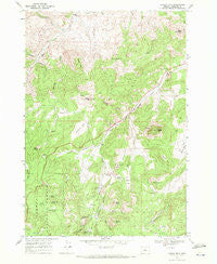
~ Lawson Mtn OR topo map, 1:24000 scale, 7.5 X 7.5 Minute, Historical, 1968, updated 1972
Lawson Mtn, Oregon, USGS topographic map dated 1968.
Includes geographic coordinates (latitude and longitude). This topographic map is suitable for hiking, camping, and exploring, or framing it as a wall map.
Printed on-demand using high resolution imagery, on heavy weight and acid free paper, or alternatively on a variety of synthetic materials.
Topos available on paper, Waterproof, Poly, or Tyvek. Usually shipping rolled, unless combined with other folded maps in one order.
- Product Number: USGS-5419682
- Free digital map download (high-resolution, GeoPDF): Lawson Mtn, Oregon (file size: 13 MB)
- Map Size: please refer to the dimensions of the GeoPDF map above
- Weight (paper map): ca. 55 grams
- Map Type: POD USGS Topographic Map
- Map Series: HTMC
- Map Verison: Historical
- Cell ID: 25165
- Scan ID: 280488
- Imprint Year: 1972
- Woodland Tint: Yes
- Aerial Photo Year: 1967
- Field Check Year: 1968
- Datum: NAD27
- Map Projection: Polyconic
- Map published by United States Geological Survey
- Map Language: English
- Scanner Resolution: 600 dpi
- Map Cell Name: Lawson Mountain
- Grid size: 7.5 X 7.5 Minute
- Date on map: 1968
- Map Scale: 1:24000
- Geographical region: Oregon, United States
Neighboring Maps:
All neighboring USGS topo maps are available for sale online at a variety of scales.
Spatial coverage:
Topo map Lawson Mtn, Oregon, covers the geographical area associated the following places:
- Gage Ranch - Spring Gulch - Payne Ranch (historical) - Beaver Spring - West Branch Cemetery - O'Kelly Creek - Slide Creek - Clover Creek - Sand Mountain - Courthouse Rock - Rail Creek - Liberty Post Office (historical) - Bailey Butte - Specht Rim - Blake Spring - Jones Ranch - Frier Spring - Fitzgerald Ranch - Mossy Rock Camp - Lewis Ditch - Carroll Creek - Stephenson Creek - Gilchrist Butte - Beaver Forest Service Station - McNeese Flat - Black Butte - Camp Creek - Post Gulch - Gage Range - Ihrig Ranch - Snowshoe Point - Lawson Mountain - Woodward Ranch - Dove Mountain - Mossy Rock Camp - Blake Flat - Gage Creek - Howard Ranch - Caesar Gulch - Do Little Flat - Sheep Mountain - Heflin Spring - Richard Butte - Hay Flat - Cougar Gulch - Lewis Butte - Sheep Smother Spring - Ross Flat
- Map Area ID: AREA44.62544.5-120.375-120.25
- Northwest corner Lat/Long code: USGSNW44.625-120.375
- Northeast corner Lat/Long code: USGSNE44.625-120.25
- Southwest corner Lat/Long code: USGSSW44.5-120.375
- Southeast corner Lat/Long code: USGSSE44.5-120.25
- Northern map edge Latitude: 44.625
- Southern map edge Latitude: 44.5
- Western map edge Longitude: -120.375
- Eastern map edge Longitude: -120.25


