
~ Jim Creek Butte OR topo map, 1:24000 scale, 7.5 X 7.5 Minute, Historical, 1963, updated 1973
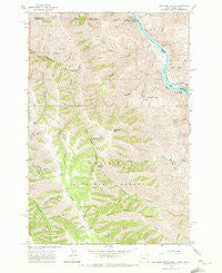
Jim Creek Butte, Oregon, USGS topographic map dated 1963.
Includes geographic coordinates (latitude and longitude). This topographic map is suitable for hiking, camping, and exploring, or framing it as a wall map.
Printed on-demand using high resolution imagery, on heavy weight and acid free paper, or alternatively on a variety of synthetic materials.
Topos available on paper, Waterproof, Poly, or Tyvek. Usually shipping rolled, unless combined with other folded maps in one order.
- Product Number: USGS-5419274
- Free digital map download (high-resolution, GeoPDF): Jim Creek Butte, Oregon (file size: 18 MB)
- Map Size: please refer to the dimensions of the GeoPDF map above
- Weight (paper map): ca. 55 grams
- Map Type: POD USGS Topographic Map
- Map Series: HTMC
- Map Verison: Historical
- Cell ID: 22618
- Scan ID: 280323
- Imprint Year: 1973
- Woodland Tint: Yes
- Aerial Photo Year: 1961
- Field Check Year: 1963
- Datum: NAD27
- Map Projection: Polyconic
- Map published by United States Geological Survey
- Map Language: English
- Scanner Resolution: 600 dpi
- Map Cell Name: Jim Creek Butte
- Grid size: 7.5 X 7.5 Minute
- Date on map: 1963
- Map Scale: 1:24000
- Geographical region: Oregon, United States
Neighboring Maps:
All neighboring USGS topo maps are available for sale online at a variety of scales.
Spatial coverage:
Topo map Jim Creek Butte, Oregon, covers the geographical area associated the following places:
- Coon Creek - Dry Creek Ridge - Downey Gulch - Cache Creek - Little Cougar Creek - Upper Cache Creek Rapids - Cold Spring Cow Camp - Cougar Rapids Bar - State Line Creek - Big Cougar Creek - South Fork Jim Creek - Lent Butte - Jack Lowery Creek - Garden Creek - Frog Pond - Baldwin Area - Spencer Creek - Lower Cochran Rapids - Cold Spring - Fir Tree Canyon - China Garden - Dry Creek - Cougar Rapids - Lower Cache Creek Rapids - Cache Creek Ranch Recreation Site - Cabin Creek - Frog Pond Butte - Cold Spring Creek - Cochran Rapids - McDuff Rapids - Old Cold Spring - Mount Wilson - Coon Hollow - Jim Creek Butte - Smooth Gulch - Chaffer Canyon - Deadhorse Creek - Upper Cochran Rapids - Road Gulch - Jenny Corral Gulch - Cold Spring Ridge - Sheldon Creek - Lower Cache Creek Rapids - Gailord Gulch - China Garden Creek - North Fork Jim Creek - Jim Creek Ranch - Downey Saddle - Cochran Islands - Cave Gulch
- Map Area ID: AREA4645.875-117-116.875
- Northwest corner Lat/Long code: USGSNW46-117
- Northeast corner Lat/Long code: USGSNE46-116.875
- Southwest corner Lat/Long code: USGSSW45.875-117
- Southeast corner Lat/Long code: USGSSE45.875-116.875
- Northern map edge Latitude: 46
- Southern map edge Latitude: 45.875
- Western map edge Longitude: -117
- Eastern map edge Longitude: -116.875


