
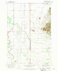
~ Indian Head OR topo map, 1:24000 scale, 7.5 X 7.5 Minute, Historical, 1969, updated 1971
Indian Head, Oregon, USGS topographic map dated 1969.
Includes geographic coordinates (latitude and longitude). This topographic map is suitable for hiking, camping, and exploring, or framing it as a wall map.
Printed on-demand using high resolution imagery, on heavy weight and acid free paper, or alternatively on a variety of synthetic materials.
Topos available on paper, Waterproof, Poly, or Tyvek. Usually shipping rolled, unless combined with other folded maps in one order.
- Product Number: USGS-5419212
- Free digital map download (high-resolution, GeoPDF): Indian Head, Oregon (file size: 9 MB)
- Map Size: please refer to the dimensions of the GeoPDF map above
- Weight (paper map): ca. 55 grams
- Map Type: POD USGS Topographic Map
- Map Series: HTMC
- Map Verison: Historical
- Cell ID: 21827
- Scan ID: 280292
- Imprint Year: 1971
- Woodland Tint: Yes
- Visual Version Number: 2
- Aerial Photo Year: 1967
- Field Check Year: 1969
- Datum: NAD27
- Map Projection: Polyconic
- Map published by United States Geological Survey
- Map Language: English
- Scanner Resolution: 600 dpi
- Map Cell Name: Indian Head
- Grid size: 7.5 X 7.5 Minute
- Date on map: 1969
- Map Scale: 1:24000
- Geographical region: Oregon, United States
Neighboring Maps:
All neighboring USGS topo maps are available for sale online at a variety of scales.
Spatial coverage:
Topo map Indian Head, Oregon, covers the geographical area associated the following places:
- Harris Cemetery - White Creek - Putnam Creek - Virgil (historical) - Tub Run - River Spur (historical) - Dinwiddie Valley - Blan Cemetery - Rowland (historical) - Pierce Creek - Twin Buttes - Twin Buttes (historical) - Folk (historical) - Brownsville Wastewater Treatment Facility - Stanwood (historical) - Harris Private School - Indian Head - Daniels Field - Rowland Post Office (historical) - Bishop Creek - Pierce Creek - Lafferty Field - Wrights Airfield (historical) - Permaneer Log Pond - Charity Grange Hall - Bond Butte - Crocus (historical) - Wigle Cemetery
- Map Area ID: AREA44.37544.25-123.125-123
- Northwest corner Lat/Long code: USGSNW44.375-123.125
- Northeast corner Lat/Long code: USGSNE44.375-123
- Southwest corner Lat/Long code: USGSSW44.25-123.125
- Southeast corner Lat/Long code: USGSSE44.25-123
- Northern map edge Latitude: 44.375
- Southern map edge Latitude: 44.25
- Western map edge Longitude: -123.125
- Eastern map edge Longitude: -123


