
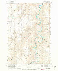
~ Indian Cove OR topo map, 1:24000 scale, 7.5 X 7.5 Minute, Historical, 1970, updated 1973
Indian Cove, Oregon, USGS topographic map dated 1970.
Includes geographic coordinates (latitude and longitude). This topographic map is suitable for hiking, camping, and exploring, or framing it as a wall map.
Printed on-demand using high resolution imagery, on heavy weight and acid free paper, or alternatively on a variety of synthetic materials.
Topos available on paper, Waterproof, Poly, or Tyvek. Usually shipping rolled, unless combined with other folded maps in one order.
- Product Number: USGS-5419206
- Free digital map download (high-resolution, GeoPDF): Indian Cove, Oregon (file size: 14 MB)
- Map Size: please refer to the dimensions of the GeoPDF map above
- Weight (paper map): ca. 55 grams
- Map Type: POD USGS Topographic Map
- Map Series: HTMC
- Map Verison: Historical
- Cell ID: 21802
- Scan ID: 280289
- Imprint Year: 1973
- Aerial Photo Year: 1969
- Field Check Year: 1970
- Datum: NAD27
- Map Projection: Lambert Conformal Conic
- Map published by United States Geological Survey
- Map Language: English
- Scanner Resolution: 600 dpi
- Map Cell Name: Indian Cove
- Grid size: 7.5 X 7.5 Minute
- Date on map: 1970
- Map Scale: 1:24000
- Geographical region: Oregon, United States
Neighboring Maps:
All neighboring USGS topo maps are available for sale online at a variety of scales.
Spatial coverage:
Topo map Indian Cove, Oregon, covers the geographical area associated the following places:
- Wilson Point - Bull Basin - Dunlap Canyon - Sproul Canyon - Warm Spring - Gooseberry Spring - Grass Canyon - Lucy Payne Canyon - Hawkins Spring - Dipping Vat Spring - North Canyon - Shellrock Canyon - Marlin Canyon - Marlin Spring - Fern Hollow - Brown Canyon - Penny Spring - Lucy Payne Spring - S A Canyon - Piano Box Canyon - Rutledge Canyon - Long Hollow - Little Ferry Canyon - Dipping Vat Canyon - Barnet Canyon - Lon Eakin Flat - Cottonwood Spring - Turner Canyon - Pearson Canyon - Cow Canyon - Sproul Point - Minton Cove - Jackknife Canyon - Hayes Canyon - Indian Cove - Nat Wheat Canyon - Steers Canyon - Peddicord Point
- Map Area ID: AREA45.37545.25-120.625-120.5
- Northwest corner Lat/Long code: USGSNW45.375-120.625
- Northeast corner Lat/Long code: USGSNE45.375-120.5
- Southwest corner Lat/Long code: USGSSW45.25-120.625
- Southeast corner Lat/Long code: USGSSE45.25-120.5
- Northern map edge Latitude: 45.375
- Southern map edge Latitude: 45.25
- Western map edge Longitude: -120.625
- Eastern map edge Longitude: -120.5


