
~ Horseshoe Bend OR topo map, 1:24000 scale, 7.5 X 7.5 Minute, Historical, 1971, updated 1973
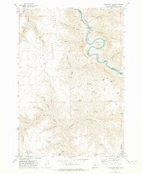
Horseshoe Bend, Oregon, USGS topographic map dated 1971.
Includes geographic coordinates (latitude and longitude). This topographic map is suitable for hiking, camping, and exploring, or framing it as a wall map.
Printed on-demand using high resolution imagery, on heavy weight and acid free paper, or alternatively on a variety of synthetic materials.
Topos available on paper, Waterproof, Poly, or Tyvek. Usually shipping rolled, unless combined with other folded maps in one order.
- Product Number: USGS-5419132
- Free digital map download (high-resolution, GeoPDF): Horseshoe Bend, Oregon (file size: 13 MB)
- Map Size: please refer to the dimensions of the GeoPDF map above
- Weight (paper map): ca. 55 grams
- Map Type: POD USGS Topographic Map
- Map Series: HTMC
- Map Verison: Historical
- Cell ID: 21124
- Scan ID: 280252
- Imprint Year: 1973
- Aerial Photo Year: 1969
- Field Check Year: 1971
- Datum: NAD27
- Map Projection: Lambert Conformal Conic
- Map published by United States Geological Survey
- Map Language: English
- Scanner Resolution: 600 dpi
- Map Cell Name: Horseshoe Bend
- Grid size: 7.5 X 7.5 Minute
- Date on map: 1971
- Map Scale: 1:24000
- Geographical region: Oregon, United States
Neighboring Maps:
All neighboring USGS topo maps are available for sale online at a variety of scales.
Spatial coverage:
Topo map Horseshoe Bend, Oregon, covers the geographical area associated the following places:
- Kelsay Canyon - Warren Spring - McInnes Spring - Norton Spring - Kent Compressor Station - Hannafin Canyon - Buckskin Canyon - Guyton Canyon - Armstrong Canyon - Sand Canyon - Cordwood Canyon - Hatley Springs - Burned Out Canyon - Vaughn Canyon - Porter Canyon - McInnes Norton Ridge - Compressor Station Number 10 Airstrip (historical) - Finster Canyon - Wolf Mountain - Horseshoe Bend - Combine Canyon - Horse Pasture Spring - Chisholm Canyon - George Wilson Ranch Airstrip (historical) - Stakely Spring - Eakin Canyon - Daugherty Canyon - Adobe Point - Potlatch Canyon
- Map Area ID: AREA45.2545.125-120.625-120.5
- Northwest corner Lat/Long code: USGSNW45.25-120.625
- Northeast corner Lat/Long code: USGSNE45.25-120.5
- Southwest corner Lat/Long code: USGSSW45.125-120.625
- Southeast corner Lat/Long code: USGSSE45.125-120.5
- Northern map edge Latitude: 45.25
- Southern map edge Latitude: 45.125
- Western map edge Longitude: -120.625
- Eastern map edge Longitude: -120.5


