
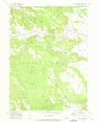
~ Horse Prairie OR topo map, 1:24000 scale, 7.5 X 7.5 Minute, Historical, 1968, updated 1972
Horse Prairie, Oregon, USGS topographic map dated 1968.
Includes geographic coordinates (latitude and longitude). This topographic map is suitable for hiking, camping, and exploring, or framing it as a wall map.
Printed on-demand using high resolution imagery, on heavy weight and acid free paper, or alternatively on a variety of synthetic materials.
Topos available on paper, Waterproof, Poly, or Tyvek. Usually shipping rolled, unless combined with other folded maps in one order.
- Product Number: USGS-5419114
- Free digital map download (high-resolution, GeoPDF): Horse Prairie, Oregon (file size: 10 MB)
- Map Size: please refer to the dimensions of the GeoPDF map above
- Weight (paper map): ca. 55 grams
- Map Type: POD USGS Topographic Map
- Map Series: HTMC
- Map Verison: Historical
- Cell ID: 21089
- Scan ID: 280243
- Imprint Year: 1972
- Woodland Tint: Yes
- Aerial Photo Year: 1967
- Field Check Year: 1968
- Datum: NAD27
- Map Projection: Polyconic
- Map published by United States Geological Survey
- Map Language: English
- Scanner Resolution: 600 dpi
- Map Cell Name: Horse Prairie
- Grid size: 7.5 X 7.5 Minute
- Date on map: 1968
- Map Scale: 1:24000
- Geographical region: Oregon, United States
Neighboring Maps:
All neighboring USGS topo maps are available for sale online at a variety of scales.
Spatial coverage:
Topo map Horse Prairie, Oregon, covers the geographical area associated the following places:
- Twin Spring - Hickey Ranch - Horse Prairie - Bowers Bridges Creek - Crane Lake - Hickey Dam - Whiskey Creek - Rogger Meadow - Walker Creek - Mud Creek - Twin Spring Recreation Site - Horse Creek - Big Valley - Squaw Butte Creek - Rogger Meadow Trailhead - Rosa Creek - Moss Ranch - Harmon Spring - Whiskey Flat - Parallel Spring - Summit Prairie - Warner Work Center - Hickey Reservoir
- Map Area ID: AREA42.2542.125-120.25-120.125
- Northwest corner Lat/Long code: USGSNW42.25-120.25
- Northeast corner Lat/Long code: USGSNE42.25-120.125
- Southwest corner Lat/Long code: USGSSW42.125-120.25
- Southeast corner Lat/Long code: USGSSE42.125-120.125
- Northern map edge Latitude: 42.25
- Southern map edge Latitude: 42.125
- Western map edge Longitude: -120.25
- Eastern map edge Longitude: -120.125


