
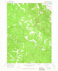
~ Harvey Creek OR topo map, 1:24000 scale, 7.5 X 7.5 Minute, Historical, 1966, updated 1968
Harvey Creek, Oregon, USGS topographic map dated 1966.
Includes geographic coordinates (latitude and longitude). This topographic map is suitable for hiking, camping, and exploring, or framing it as a wall map.
Printed on-demand using high resolution imagery, on heavy weight and acid free paper, or alternatively on a variety of synthetic materials.
Topos available on paper, Waterproof, Poly, or Tyvek. Usually shipping rolled, unless combined with other folded maps in one order.
- Product Number: USGS-5418948
- Free digital map download (high-resolution, GeoPDF): Harvey Creek, Oregon (file size: 11 MB)
- Map Size: please refer to the dimensions of the GeoPDF map above
- Weight (paper map): ca. 55 grams
- Map Type: POD USGS Topographic Map
- Map Series: HTMC
- Map Verison: Historical
- Cell ID: 19575
- Scan ID: 280158
- Imprint Year: 1968
- Woodland Tint: Yes
- Aerial Photo Year: 1963
- Field Check Year: 1966
- Datum: NAD27
- Map Projection: Polyconic
- Map published by United States Geological Survey
- Map Language: English
- Scanner Resolution: 600 dpi
- Map Cell Name: Harvey Creek
- Grid size: 7.5 X 7.5 Minute
- Date on map: 1966
- Map Scale: 1:24000
- Geographical region: Oregon, United States
Neighboring Maps:
All neighboring USGS topo maps are available for sale online at a variety of scales.
Spatial coverage:
Topo map Harvey Creek, Oregon, covers the geographical area associated the following places:
- Taylor Buttes - Winter Ridge - Bennett Flat - Hogwallow Spring - Rock Creek - Rock Creek Recreation Site - Hanan/Coffeepot Spring Recreation Site - Kelly Creek - Winter Rim Trailhead - Harvey Creek - Bed Spring - Hanan Sycan Trailhead - Boulder Spring - Currier Spring - Cold Spring - Cummings Creek - Nixon Creek - Boulder Creek - Kates Dairy - Government Harvey Pass - Wooley Creek - Phelps Spring - Harvey Flat - Harvey Spring - Skull Creek Camp - Snow Cabin - South Fork Sycan River
- Map Area ID: AREA42.7542.625-120.875-120.75
- Northwest corner Lat/Long code: USGSNW42.75-120.875
- Northeast corner Lat/Long code: USGSNE42.75-120.75
- Southwest corner Lat/Long code: USGSSW42.625-120.875
- Southeast corner Lat/Long code: USGSSE42.625-120.75
- Northern map edge Latitude: 42.75
- Southern map edge Latitude: 42.625
- Western map edge Longitude: -120.875
- Eastern map edge Longitude: -120.75


