
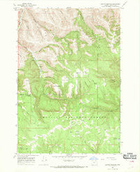
~ Granite Meadows OR topo map, 1:24000 scale, 7.5 X 7.5 Minute, Historical, 1967, updated 1969
Granite Meadows, Oregon, USGS topographic map dated 1967.
Includes geographic coordinates (latitude and longitude). This topographic map is suitable for hiking, camping, and exploring, or framing it as a wall map.
Printed on-demand using high resolution imagery, on heavy weight and acid free paper, or alternatively on a variety of synthetic materials.
Topos available on paper, Waterproof, Poly, or Tyvek. Usually shipping rolled, unless combined with other folded maps in one order.
- Product Number: USGS-5418760
- Free digital map download (high-resolution, GeoPDF): Granite Meadows, Oregon (file size: 15 MB)
- Map Size: please refer to the dimensions of the GeoPDF map above
- Weight (paper map): ca. 55 grams
- Map Type: POD USGS Topographic Map
- Map Series: HTMC
- Map Verison: Historical
- Cell ID: 70232
- Scan ID: 280063
- Imprint Year: 1969
- Woodland Tint: Yes
- Aerial Photo Year: 1965
- Field Check Year: 1967
- Datum: NAD27
- Map Projection: Polyconic
- Map published by United States Geological Survey
- Map Language: English
- Scanner Resolution: 600 dpi
- Map Cell Name: Granite Meadows
- Grid size: 7.5 X 7.5 Minute
- Date on map: 1967
- Map Scale: 1:24000
- Geographical region: Oregon, United States
Neighboring Maps:
All neighboring USGS topo maps are available for sale online at a variety of scales.
Spatial coverage:
Topo map Granite Meadows, Oregon, covers the geographical area associated the following places:
- Blue Gulch - Warner Family Cemetery - Hascall Spring - Granite Meadows - Kenny Gulch - Rowley Cabin Spring - Sagebrush Flat - Beeman Canyon - Albee Meadow - Pine Grove Post Office (historical) - Bradley Flat Spring - Chute Gulch - South Canyon - West Gulch - Lower Bench - Table Mountain - Fall Gulch - Pine Grove - South Prairie - Bear Wallow Camp Recreation Site (historical) - Table Mountain Gulch - Upper Bench - Bradley Flat - Cold Spring Canyon - Coyote Gulch - Merle Gulch - Cold Spring - Bear Wallow Forest Service Station
- Map Area ID: AREA45.37545.25-118.875-118.75
- Northwest corner Lat/Long code: USGSNW45.375-118.875
- Northeast corner Lat/Long code: USGSNE45.375-118.75
- Southwest corner Lat/Long code: USGSSW45.25-118.875
- Southeast corner Lat/Long code: USGSSE45.25-118.75
- Northern map edge Latitude: 45.375
- Southern map edge Latitude: 45.25
- Western map edge Longitude: -118.875
- Eastern map edge Longitude: -118.75


