
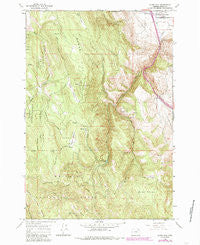
~ Glass Hill OR topo map, 1:24000 scale, 7.5 X 7.5 Minute, Historical, 1965, updated 1985
Glass Hill, Oregon, USGS topographic map dated 1965.
Includes geographic coordinates (latitude and longitude). This topographic map is suitable for hiking, camping, and exploring, or framing it as a wall map.
Printed on-demand using high resolution imagery, on heavy weight and acid free paper, or alternatively on a variety of synthetic materials.
Topos available on paper, Waterproof, Poly, or Tyvek. Usually shipping rolled, unless combined with other folded maps in one order.
- Product Number: USGS-5418696
- Free digital map download (high-resolution, GeoPDF): Glass Hill, Oregon (file size: 18 MB)
- Map Size: please refer to the dimensions of the GeoPDF map above
- Weight (paper map): ca. 55 grams
- Map Type: POD USGS Topographic Map
- Map Series: HTMC
- Map Verison: Historical
- Cell ID: 17378
- Scan ID: 280029
- Imprint Year: 1985
- Woodland Tint: Yes
- Photo Revision Year: 1984
- Aerial Photo Year: 1981
- Edit Year: 1984
- Field Check Year: 1981
- Datum: NAD27
- Map Projection: Polyconic
- Map published by United States Geological Survey
- Map Language: English
- Scanner Resolution: 600 dpi
- Map Cell Name: Glass Hill
- Grid size: 7.5 X 7.5 Minute
- Date on map: 1965
- Map Scale: 1:24000
- Geographical region: Oregon, United States
Neighboring Maps:
All neighboring USGS topo maps are available for sale online at a variety of scales.
Spatial coverage:
Topo map Glass Hill, Oregon, covers the geographical area associated the following places:
- Charles Reynolds Safety Rest Area - Morris Hill - Glass Hill - Tamarack Mountain - Ladd Canyon - Reinecke Cabin - Spring Flat - West Fork Clear Creek - Mann Ridge - Clay Spring - Ladd Canyon Sno-Park - Vincent Ranch - Ladd Canyon Pond - Howard Meadow - East Fork Rock Creek - Baldy - Long Prairie - Howard Meadow Trail
- Map Area ID: AREA45.2545.125-118.125-118
- Northwest corner Lat/Long code: USGSNW45.25-118.125
- Northeast corner Lat/Long code: USGSNE45.25-118
- Southwest corner Lat/Long code: USGSSW45.125-118.125
- Southeast corner Lat/Long code: USGSSE45.125-118
- Northern map edge Latitude: 45.25
- Southern map edge Latitude: 45.125
- Western map edge Longitude: -118.125
- Eastern map edge Longitude: -118


