
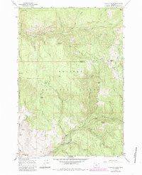
~ Flagstaff Butte OR topo map, 1:24000 scale, 7.5 X 7.5 Minute, Historical, 1965, updated 1985
Flagstaff Butte, Oregon, USGS topographic map dated 1965.
Includes geographic coordinates (latitude and longitude). This topographic map is suitable for hiking, camping, and exploring, or framing it as a wall map.
Printed on-demand using high resolution imagery, on heavy weight and acid free paper, or alternatively on a variety of synthetic materials.
Topos available on paper, Waterproof, Poly, or Tyvek. Usually shipping rolled, unless combined with other folded maps in one order.
- Product Number: USGS-5418416
- Free digital map download (high-resolution, GeoPDF): Flagstaff Butte, Oregon (file size: 15 MB)
- Map Size: please refer to the dimensions of the GeoPDF map above
- Weight (paper map): ca. 55 grams
- Map Type: POD USGS Topographic Map
- Map Series: HTMC
- Map Verison: Historical
- Cell ID: 15448
- Scan ID: 279889
- Imprint Year: 1985
- Woodland Tint: Yes
- Photo Revision Year: 1984
- Aerial Photo Year: 1981
- Edit Year: 1984
- Field Check Year: 1981
- Datum: NAD27
- Map Projection: Polyconic
- Map published by United States Geological Survey
- Map Language: English
- Scanner Resolution: 600 dpi
- Map Cell Name: Flagstaff Butte
- Grid size: 7.5 X 7.5 Minute
- Date on map: 1965
- Map Scale: 1:24000
- Geographical region: Oregon, United States
Neighboring Maps:
All neighboring USGS topo maps are available for sale online at a variety of scales.
Spatial coverage:
Topo map Flagstaff Butte, Oregon, covers the geographical area associated the following places:
- Trout Creek - Velvet Creek - Sufferin Smith Spring - Bazine Spring - Gobel Draw - Marlin Spring - Argenti Spring - Taylor Green - Pole Creek - Big Hill - The Black Pines - Cold Spring - Camp Creek - Lick Creek - Trout Creek - Pawnee Gulch - Happy Canyon - Sand Pass Creek - Collins Creek - Huckleberry Spring - Conundrum Creek - Gravel Flat - Universal Spring - Fairview Point - Four Point Ridge - Corral Creek - South Catherine Ditch - Flagstaff Butte - Mud Spring - Prong Creek - Burn Creek - Alder Creek - Angel Point - Bottle Creek - Bald Hill - Burn Creek Mine - Happy Spring
- Map Area ID: AREA45.12545-117.625-117.5
- Northwest corner Lat/Long code: USGSNW45.125-117.625
- Northeast corner Lat/Long code: USGSNE45.125-117.5
- Southwest corner Lat/Long code: USGSSW45-117.625
- Southeast corner Lat/Long code: USGSSE45-117.5
- Northern map edge Latitude: 45.125
- Southern map edge Latitude: 45
- Western map edge Longitude: -117.625
- Eastern map edge Longitude: -117.5


