
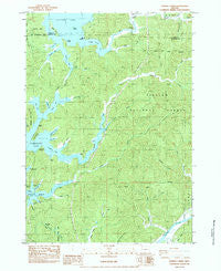
~ Fivemile Creek OR topo map, 1:24000 scale, 7.5 X 7.5 Minute, Historical, 1984, updated 1987
Fivemile Creek, Oregon, USGS topographic map dated 1984.
Includes geographic coordinates (latitude and longitude). This topographic map is suitable for hiking, camping, and exploring, or framing it as a wall map.
Printed on-demand using high resolution imagery, on heavy weight and acid free paper, or alternatively on a variety of synthetic materials.
Topos available on paper, Waterproof, Poly, or Tyvek. Usually shipping rolled, unless combined with other folded maps in one order.
- Product Number: USGS-5418404
- Free digital map download (high-resolution, GeoPDF): Fivemile Creek, Oregon (file size: 16 MB)
- Map Size: please refer to the dimensions of the GeoPDF map above
- Weight (paper map): ca. 55 grams
- Map Type: POD USGS Topographic Map
- Map Series: HTMC
- Map Verison: Historical
- Cell ID: 15425
- Scan ID: 279882
- Imprint Year: 1987
- Woodland Tint: Yes
- Aerial Photo Year: 1976
- Edit Year: 1984
- Field Check Year: 1978
- Datum: NAD27
- Map Projection: Lambert Conformal Conic
- Provisional map: Yes
- Map published by United States Geological Survey
- Map Language: English
- Scanner Resolution: 600 dpi
- Map Cell Name: Fivemile Creek
- Grid size: 7.5 X 7.5 Minute
- Date on map: 1984
- Map Scale: 1:24000
- Geographical region: Oregon, United States
Neighboring Maps:
All neighboring USGS topo maps are available for sale online at a variety of scales.
Spatial coverage:
Topo map Fivemile Creek, Oregon, covers the geographical area associated the following places:
- Snake Point - Booth (historical) - Harmony Bay - Ruby Post Office (historical) - King Creek - Cherry Arm - Booth Ridge - Ada (historical) - Mallard Arm - Young Creek - Gardiner Landing - Gardiner County Park Boat Ramp / Dock - Leitel Creek - Frarey Creek - Fiddle Creek - Mallard Creek - Halfway Point - Brenham (historical) - Lane Creek - Crabtree Point - Siuslaw Valley Fire and Rescue Station 6 Ada Station - Booth Post Office (historical) - Bombard Bay - Black Creek - Booth Arm - Cherry Point - Fir Grove Cemetery - Pretty Gulch - Lone Tree Point - Bass (historical) - Dismal Swamp - Joyce Creek - North Arm - Middle Point - Bedolf Arm - The Isthmus - Independent Order of Odd Fellows Cemeteries - Ada Station - Cleves Cove - Snare Point - Tahkenitch Lake - Bear Creek - Bell Creek - Big Arm - Rocky Point - H P Dutton Lumber Company (historical) - Miles Canyon - Fiddle Creek Arm Siltcoos Lake - Isthmus Point - Booth Island - John Sims Creek - Perkins Creek - Reed Island - Alder Creek - Ada County Park Boat Ramp - Five Mile Arm - Ada Post Office (historical) - Fingerboard Slough Creek - Harry Creek - Catfish Hole - Holden Creek - Ada Resort Boat Ramp - Booth Landing - Bear Trap Arm - Ada County Park - Fivemile Creek - Spike Arm - Patterson Creek - Silver Creek
- Map Area ID: AREA43.87543.75-124.125-124
- Northwest corner Lat/Long code: USGSNW43.875-124.125
- Northeast corner Lat/Long code: USGSNE43.875-124
- Southwest corner Lat/Long code: USGSSW43.75-124.125
- Southeast corner Lat/Long code: USGSSE43.75-124
- Northern map edge Latitude: 43.875
- Southern map edge Latitude: 43.75
- Western map edge Longitude: -124.125
- Eastern map edge Longitude: -124


