
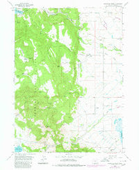
~ Fitzwater Point OR topo map, 1:24000 scale, 7.5 X 7.5 Minute, Historical, 1964, updated 1980
Fitzwater Point, Oregon, USGS topographic map dated 1964.
Includes geographic coordinates (latitude and longitude). This topographic map is suitable for hiking, camping, and exploring, or framing it as a wall map.
Printed on-demand using high resolution imagery, on heavy weight and acid free paper, or alternatively on a variety of synthetic materials.
Topos available on paper, Waterproof, Poly, or Tyvek. Usually shipping rolled, unless combined with other folded maps in one order.
- Product Number: USGS-5418390
- Free digital map download (high-resolution, GeoPDF): Fitzwater Point, Oregon (file size: 11 MB)
- Map Size: please refer to the dimensions of the GeoPDF map above
- Weight (paper map): ca. 55 grams
- Map Type: POD USGS Topographic Map
- Map Series: HTMC
- Map Verison: Historical
- Cell ID: 15395
- Scan ID: 279876
- Imprint Year: 1980
- Woodland Tint: Yes
- Photo Revision Year: 1980
- Aerial Photo Year: 1979
- Edit Year: 1980
- Field Check Year: 1964
- Datum: NAD27
- Map Projection: Polyconic
- Map published by United States Geological Survey
- Map Language: English
- Scanner Resolution: 600 dpi
- Map Cell Name: Fitzwater Point
- Grid size: 7.5 X 7.5 Minute
- Date on map: 1964
- Map Scale: 1:24000
- Geographical region: Oregon, United States
Neighboring Maps:
All neighboring USGS topo maps are available for sale online at a variety of scales.
Spatial coverage:
Topo map Fitzwater Point, Oregon, covers the geographical area associated the following places:
- Sibley Draw - East Canal - Renner Ranch - Drews Dam - Renner Reservoir - Becraft Ranch - County Spring - South Canal - Lone Pine Spring - Mill Flat - Behm Ranch - Friday Ranch - Fish Creek - Ashcraft Flume - Theora Post Office (historical) - Briggs Ranch - Mill Spring - Fitzwater Pass Spring - Whiskey Creek - West Side Cemetery - Drews Creek Recreation Site - Horseshoe Spring - Miners Cabin Spring - Trail Spring - Fitzwater Point - Bee Spring - Venator Creek - Goose Lake Timber Camp - Ashcraft Ranch - Mud Spring - Renner Dam - Lakeview Water Users Headquarters - Juniper Post Office (historical) - Drews Reservoir Boat Ramp - Fitzwater Pass - Stover Reservoir - Horseshoe Meadow - Whiskey Spring - East Fork McCoin Creek - Little Horseshoe Spring - Drews Reservoir County Park
- Map Area ID: AREA42.12542-120.625-120.5
- Northwest corner Lat/Long code: USGSNW42.125-120.625
- Northeast corner Lat/Long code: USGSNE42.125-120.5
- Southwest corner Lat/Long code: USGSSW42-120.625
- Southeast corner Lat/Long code: USGSSE42-120.5
- Northern map edge Latitude: 42.125
- Southern map edge Latitude: 42
- Western map edge Longitude: -120.625
- Eastern map edge Longitude: -120.5


