
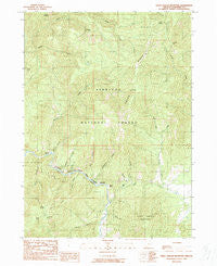
~ Eight Dollar Mountain OR topo map, 1:24000 scale, 7.5 X 7.5 Minute, Historical, 1989, updated 1989
Eight Dollar Mountain, Oregon, USGS topographic map dated 1989.
Includes geographic coordinates (latitude and longitude). This topographic map is suitable for hiking, camping, and exploring, or framing it as a wall map.
Printed on-demand using high resolution imagery, on heavy weight and acid free paper, or alternatively on a variety of synthetic materials.
Topos available on paper, Waterproof, Poly, or Tyvek. Usually shipping rolled, unless combined with other folded maps in one order.
- Product Number: USGS-5418174
- Free digital map download (high-resolution, GeoPDF): Eight Dollar Mountain, Oregon (file size: 17 MB)
- Map Size: please refer to the dimensions of the GeoPDF map above
- Weight (paper map): ca. 55 grams
- Map Type: POD USGS Topographic Map
- Map Series: HTMC
- Map Verison: Historical
- Cell ID: 13769
- Scan ID: 279767
- Imprint Year: 1989
- Woodland Tint: Yes
- Aerial Photo Year: 1984
- Edit Year: 1900
- Field Check Year: 1986
- Datum: NAD27
- Map Projection: Lambert Conformal Conic
- Provisional map: Yes
- Map published by United States Geological Survey
- Map Language: English
- Scanner Resolution: 600 dpi
- Map Cell Name: Eight Dollar Mountain
- Grid size: 7.5 X 7.5 Minute
- Date on map: 1989
- Map Scale: 1:24000
- Geographical region: Oregon, United States
Neighboring Maps:
All neighboring USGS topo maps are available for sale online at a variety of scales.
Spatial coverage:
Topo map Eight Dollar Mountain, Oregon, covers the geographical area associated the following places:
- Shade Creek - Eight Dollar Mountain - Baldwin Gulch - Zigzag Creek - Spaulding Mill - Coonskin - Squaw Mountain - Alder Gulch - Spring Creek - Spalding Pond Recreation Site - Cedar Gulch - West Fork Squaw Creek - Ellis Creek - Mikes Gulch - Bour Post Office (historical) - Gold Blanket Mine - Sixmile Creek - Snailback Creek - Fayes Gulch - Eight Dollar Mountain Creek - Deer Creek - Horse Creek - Star Flat - Clear Creek - Squaw Ridge - Kerby Flat - Lookout Gap - Squaw Creek - Anderson Mine - Little Sixmile Creek - Wheeler City (historical) - Serpentine Point - Hoover Gulch - Pockett Knoll - East Fork Squaw Creek
- Map Area ID: AREA42.37542.25-123.75-123.625
- Northwest corner Lat/Long code: USGSNW42.375-123.75
- Northeast corner Lat/Long code: USGSNE42.375-123.625
- Southwest corner Lat/Long code: USGSSW42.25-123.75
- Southeast corner Lat/Long code: USGSSE42.25-123.625
- Northern map edge Latitude: 42.375
- Southern map edge Latitude: 42.25
- Western map edge Longitude: -123.75
- Eastern map edge Longitude: -123.625


