
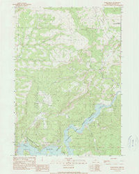
~ Eagle Rock OR topo map, 1:24000 scale, 7.5 X 7.5 Minute, Historical, 1990, updated 1990
Eagle Rock, Oregon, USGS topographic map dated 1990.
Includes geographic coordinates (latitude and longitude). This topographic map is suitable for hiking, camping, and exploring, or framing it as a wall map.
Printed on-demand using high resolution imagery, on heavy weight and acid free paper, or alternatively on a variety of synthetic materials.
Topos available on paper, Waterproof, Poly, or Tyvek. Usually shipping rolled, unless combined with other folded maps in one order.
- Product Number: USGS-5418136
- Free digital map download (high-resolution, GeoPDF): Eagle Rock, Oregon (file size: 6 MB)
- Map Size: please refer to the dimensions of the GeoPDF map above
- Weight (paper map): ca. 55 grams
- Map Type: POD USGS Topographic Map
- Map Series: HTMC
- Map Verison: Historical
- Cell ID: 13282
- Scan ID: 279747
- Imprint Year: 1990
- Woodland Tint: Yes
- Aerial Photo Year: 1984
- Edit Year: 1991
- Field Check Year: 1986
- Datum: NAD27
- Map Projection: Lambert Conformal Conic
- Provisional map: Yes
- Map Language: English
- Scanner Resolution: 400 dpi
- Map Cell Name: Eagle Rock
- Grid size: 7.5 X 7.5 Minute
- Date on map: 1990
- Map Scale: 1:24000
- Geographical region: Oregon, United States
Neighboring Maps:
All neighboring USGS topo maps are available for sale online at a variety of scales.
Spatial coverage:
Topo map Eagle Rock, Oregon, covers the geographical area associated the following places:
- Way Ranch - Roberts Bay Boat Launch - Eagle Rock - Long Hollow - Big Bend Island - Owl Creek - Carey Ranch - Eagle Creek - Prinville Reservoir State Park Boat Ramp - Jasper Point Boat Ramp - Deer Creek - O'Neil Creek - Klaus Ranch - Bailey School (historical) - Sanford Creek - Mayfield Ranch - Prineville Reservoir - Antelope Creek - Prineville Reservoir State Park Marina - Sand Creek
- Map Area ID: AREA44.2544.125-120.75-120.625
- Northwest corner Lat/Long code: USGSNW44.25-120.75
- Northeast corner Lat/Long code: USGSNE44.25-120.625
- Southwest corner Lat/Long code: USGSSW44.125-120.75
- Southeast corner Lat/Long code: USGSSE44.125-120.625
- Northern map edge Latitude: 44.25
- Southern map edge Latitude: 44.125
- Western map edge Longitude: -120.75
- Eastern map edge Longitude: -120.625


