
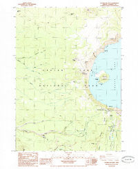
~ Crater Lake West OR topo map, 1:24000 scale, 7.5 X 7.5 Minute, Historical, 1985, updated 1985
Crater Lake West, Oregon, USGS topographic map dated 1985.
Includes geographic coordinates (latitude and longitude). This topographic map is suitable for hiking, camping, and exploring, or framing it as a wall map.
Printed on-demand using high resolution imagery, on heavy weight and acid free paper, or alternatively on a variety of synthetic materials.
Topos available on paper, Waterproof, Poly, or Tyvek. Usually shipping rolled, unless combined with other folded maps in one order.
- Product Number: USGS-5417656
- Free digital map download (high-resolution, GeoPDF): Crater Lake West, Oregon (file size: 10 MB)
- Map Size: please refer to the dimensions of the GeoPDF map above
- Weight (paper map): ca. 55 grams
- Map Type: POD USGS Topographic Map
- Map Series: HTMC
- Map Verison: Historical
- Cell ID: 10607
- Scan ID: 279505
- Imprint Year: 1985
- Woodland Tint: Yes
- Aerial Photo Year: 1982
- Edit Year: 1985
- Field Check Year: 1982
- Datum: NAD27
- Map Projection: Lambert Conformal Conic
- Provisional map: Yes
- Map Language: English
- Scanner Resolution: 600 dpi
- Map Cell Name: Crater Lake West
- Grid size: 7.5 X 7.5 Minute
- Date on map: 1985
- Map Scale: 1:24000
- Geographical region: Oregon, United States
Neighboring Maps:
All neighboring USGS topo maps are available for sale online at a variety of scales.
Spatial coverage:
Topo map Crater Lake West, Oregon, covers the geographical area associated the following places:
- Munson Ridge - Crater Lake National Park - Summit Cascade Divide - Witches Cauldron - Merriam Point - Governors Bay - Trapper Creek - Llao Bay - Lightening Spring Trail - Rim Village Picnic Area - Munson Springs - National Park Service Crater Lake National Park Ranger Station - Castle Creek Trail - Eagle Cove - Devils Backbone - Castle Crest - Dutton Creek Trail - Sinnott Memorial - Llao Rock - Crater Lake Post Office - Middle Fork Copeland Creek - Whitehorse Creek - Dutton Creek - Fumarole Bay - Discovery Point - Wizard Island - Williams Crater - Llaos Hallway - Red Cone Spring - Crater Lake National Park Fire Department - Lightning Spring - Rim of the Crater - Red Cone - Crater Lake Lodge - Rim Village - South Fork Copeland Creek - Bybee Meadow Trail - Whitehorse Bluff - Crater Lake National Park Headquarters - Victor Rock - Skell Channel - Whitehorse Pond - Hillman Peak - Munson Point - Cascade Divide Trail - Elephants Back - The Watchman
- Map Area ID: AREA4342.875-122.25-122.125
- Northwest corner Lat/Long code: USGSNW43-122.25
- Northeast corner Lat/Long code: USGSNE43-122.125
- Southwest corner Lat/Long code: USGSSW42.875-122.25
- Southeast corner Lat/Long code: USGSSE42.875-122.125
- Northern map edge Latitude: 43
- Southern map edge Latitude: 42.875
- Western map edge Longitude: -122.25
- Eastern map edge Longitude: -122.125


